Projects
GLOS projects support science, policy, management, and industry in the Great Lakes. When picking projects, we’re guided by our priorities.
GLOS Projects
GLOS projects seek to boost the resilience of coastal communities, economies, and ecosystems, by developing tools to put actionable information in the hands of more people for decision-making, and increase the shared understanding of climate-induced coastal impacts to the Great Lakes. These efforts require community engagement, outreach, and co-production of knowledge that communities and stakeholders can readily use.
Current and ongoing GLOS projects include the expansion of capabilities of Seagull, GLOS’ information technology platform, based on community feedback, as well as development of a lightweight application focused on Great Lakes Beach safety and custom deployments of Seagull. Additional projects focus on coordination with the Smart Great Lakes Initiative (SGLi), Indigenous Great Lakes Network (IGLN), augmentation of the Great Lakes Acoustic Telemetry Observation System to include additional parameters, and collection of ice thickness measurements from ice anglers to help validate ice modeling efforts.
All of our projects align with our core values, contribute to one or more of our impact areas, and serve to advance one or more of our programmatic initiatives.
Current and Ongoing

Ocean Technology Transition Project (OTT)
Communities are limited by the existing frequency gap in coastal observations that this project will address by providing a nearshore system that captures full-frequency information and finally fills an observational gap that has historically left communities vulnerable to many kinds of hazards.
The overarching goal of the project is to develop both a low-cost observing network capable of gathering offshore full-frequency water level fluctuations and the methodology to relate that data with the most pressing water level-related coastal hazards.
The Great Lakes Observing System (GLOS) is leading the project with support from investigators and collaborators from University of Wisconsin-Madison, Colorado School of Mines, Michigan Technological University, Sofar Ocean Technologies, and NOAA CO-OPS.
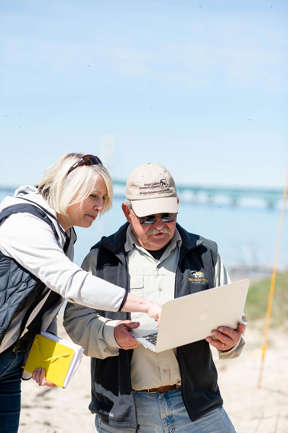
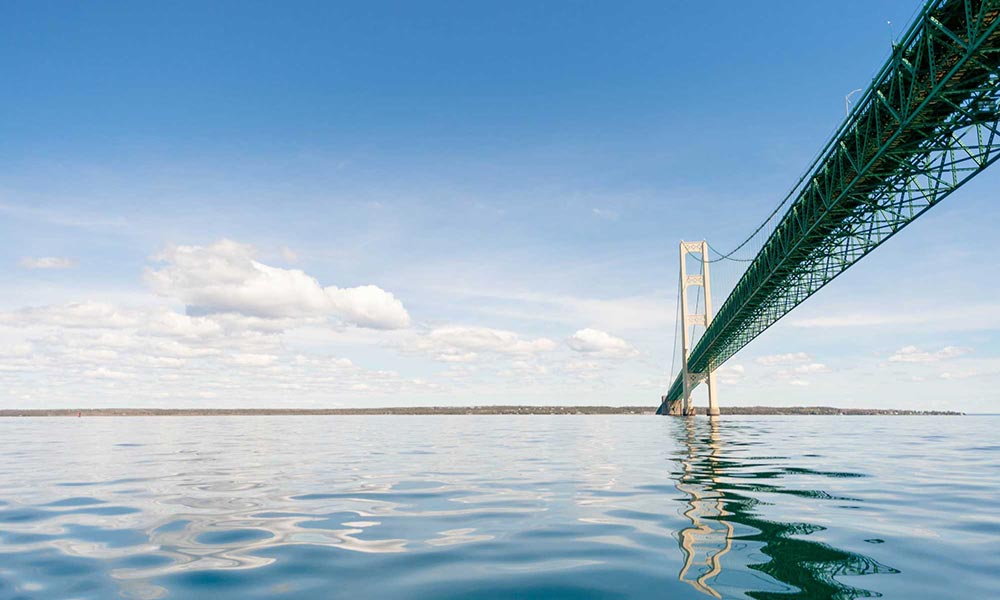
Funding High Frequency Radar in Straits of Mackinac
(Left to right) Dr. Lorelle Meadows and Dr. Guy Meadows, both researchers at Michigan Technological University, are spearheading the project, including the installation of the radar units.
Those seeking to monitor currents in the Straits of Mackinac will soon have high-quality data at their fingertips thanks to one of GLOS’ latest projects. By securing a NOAA grant, GLOS is funding the purchase of a high frequency radar system that will give detailed information on water currents through the narrow straits.

Supporting the Nearshore Observations Network
This partner network operates key observing platforms and modeling improvements vital to the Great Lakes.
Platforms include an array of integrated nearshore observing buoys that provide continuous, real-time observations on wind, wave, temperature, and currents along with expanded water quality analysis. Mobile observing platforms, including a glider and autonomous underwater vehicles, provide detailed, three-dimensional observations of thermal structure, and ecological processes throughout each of the Great Lakes.
Observations include surveys focused on understanding harmful algal blooms, impacts of invasive species, and coastal nutrient inputs. Observational activities are tailored to local user-driven needs and the needs of the broader Great Lakes region.
Partners include University of Minnesota-Duluth, Michigan Technological University, University of Wisconsin-Milwaukee, State University of New York, NOAA GLERL, Cooperative Institute for Limnology and Ecosystems Research.

Helping to Monitor Harmful Algal Blooms
Since 2015, with support from Ohio EPA and the US Integrated Ocean Observing System (IOOS), GLOS, with a wide range of partners, has worked to procure, deploy, and/or integrate data from water quality instrumentation to provide real-time HABs-related data to stakeholders.
Past Projects
Supporting the Great Lakes Bottom Mapping Working Group
The Great Lakes Bottom Mapping Working Group (BMWG) was formed in 2016 to facilitate the collection, harmonization, sharing, and use of continuous high-resolution maps and data about Great Lakes bathymetry, habitat, maritime cultural resources, and biology.
Funded and co-led by the U.S. Geological Survey, the working group is a collaborative effort to promote communication and collaboration among data providers and users. The group facilitates access to data, promotes the use of technical standards for mapping and habitat classification, and prioritizes regional mapping needs.
The BMWG has since disbanded and reformed through the Lakebed 2030, Building the Great Map, of which GLOS is a member of the core team.


Smart Great Lakes Mini-Grant projects
The Smart Great Lakes Mini-Grants program intends to advance the:
- Development and deployment smart technologies to improve the monitoring of the ecological health of the Great Lakes and the effective management of data.
- Effective data management.
- Creation of information tools that serve stakeholders’ needs.
In 2021, GLOS awarded 24 grants ranging from $20,000 up to $150,000 USD for projects ranging from standard deployment of observing equipment, to the development of models, to crowdsourced lakebed mapping.
Awards were issued in April 2021, and projects began in May 2021. Working to advance the Smart Great Lakes vision, GLOS staff work with grantees to complete the projects and, share data publicly through GLOS’ Seagull platform.


Enabling Ontario’s Conservation Authorities (CAs) to Make Data Discoverable and Accessible
Authorities collect, store and analyze environmental data employing a variety of observational and remote sensing systems such as ground and surface water monitoring networks, climate stations, and GIS systems.
To date, most of these data have been collected and used internally—shared only with project partners in an on-demand fashion and typically not accessed by U.S. entities. This project enables CAs to make these data discoverable, accessible and available by assisting with their inventory, assessment and preparation. Specific outcomes are an assessment of existing and potential data end-users and data products, making data available through GLOS, and development of tools to assist end-users in utilizing newly available data.
Partners include Conservation Ontario, North Bay-Mattawa Conservation Authority, Quinte Conservation Authority, Lake Simcoe Region Conservation Authority, Grand River Conservation Authority Conservation
Contact: Rick Wilson, Information Management Coordinator, rwilson@conservationontario.ca


Making the Huron-Erie Corridor safer through a new spill modeling tool
The Huron-Erie Corridor is an area especially vulnerable to
chemical spills from heavy industry. In order to provide water treatment managers with a tool to help make critical decisions during spills, GLOS worked with Michigan Tech Research Institute and NOAA Great Lakes Environmental Research Laboratory to develop a tool that allows users to visualize how spills can travel through the corridor, enabling them to make more informed decisions to ensure drinking water quality.


Validating and Expanding the Great Lakes Adaptation Data Suite (GLADS)
GLOS funded work at the Great Lakes Integrated Sciences and Assessments (GLISA) program in developing a consistent Great Lakes Climate Adaptation Suite (GLADS) that would serve as a tool for understanding our changing climate. This work is being expanded as GLISA works to incorporate GLADS into their widely-used climatologies, or summaries of observational data, and will also include incorporating future climate projections into their models.
GLOS hosts and maintains this data for public access to enable:
- More accurate Great Lakes climate data based on real-time Great Lakes observation data.
- Making that data more accessible to city managers and decision-makers.
Great Lakes Beaches: Expanding GLOS Data Services for Sustainable Decision Support in Water Quality
With GLOS data, related services and tools, the University of Wisconsin Sea Grant Institute developed a suite of enhancements to its water quality nowcast models, including the Great Lakes Coastal Forecasting System and the Environmental Data Discovery and Transformation (EnDDaT) web data portal that links data services to the Virtual Beach decision-support software.
Public health officials, staff, and researchers responsible for monitoring, advisory decisions, and/or risk communications at public beaches along the Great Lakes coasts can use these tools to complement the water quality samples at public beaches.
Partners include University of Wisconsin Sea Grant Institute and United States Geological Survey Water Resources Mission Area
Contact: David Hart, Assistant Director of Extension, Wisconsin Sea Grant Institute, dhart@aqua.wisc.edu
Expanding the Great Lakes Telemetry Observation System (GLATOS)
The current Great Lakes Acoustic Telemetry Observation System web (GLATOSweb) data system, developed by GLOS in partnership with the GLFC, was designed to promote discovery of individual telemetry research projects to extend their effective range, but it does not provide direct access to data or include mechanisms for quality assurance.
This project updates the back-end database design to support more efficient data management and access via GLATOSweb. It ensures compliance with IOOS requirements to establish GLATOS as a fully-integrated augmented transition network node of the national Animal Telemetry Network.
Partners include Great Lakes Fishery Commission (GLFC), Michigan State University, and U.S. Geological Survey.
Contact: Jessica Ives, Great Lakes Fishery Commission, jives@glfc.org
Great Lakes Evaporation Network (GLEN)
The GLEN is composed of five offshore measurement locations. This network operates simultaneously year-round, even through bitter winters, helping us understand the evaporation process that takes place over the Great Lakes.
This project enhances the existing GLEN infrastructure and (together with significantly leveraged support from NOAA and Environment Canada) provides a foundation for new partners to contribute observing assets, modeling tools, and outreach. The project worked to:
-
- Maintain and expand the suite of GLEN observations (e.g, observation sites, buoys, and glider deployments).
- Establish a coordinated data management and communications system through GLOS.
- Develop new models and tools to synthesize and communicate GLEN data and improve Great Lakes forecasting.
Partners include LimnoTech, University of Colorado-Boulder, Environment and Climate Change Canada, National Oceanic and Atmospheric Administration Great Lakes Environmental Research Lab (GLERL), University of Minnesota-Duluth, Northern Michigan University, University of Michigan, Michigan Technological University
Contact: John Lenters, Consultant, jlenters@mac.com
Hydronamic model for the St. Louis River Estuary and Duluth-Superior Harbor system
Partners: University of Minnesota-Duluth (UMD)
University of Minnesota-Duluth further developed an existing hydrodynamic model of the St. Louis River Estuary/ Duluth-Superior Harbor. The model simulates the impact of meteorology on the St. Louis River Estuary system, producing physically realistic and ground-truthed estimates of currents and thermal structure in the system. Enhancements to the model included the addition of ecosystem and water quality, improvement of the nowcasting capability, and an enhanced web presence for model output. A coordinated water quality and ecosystem monitoring program with project partners (e.g., the extensive network of academic, state, federal, tribal, commercial, and non-profit groups who all have a stake in the Harbor-Estuary system) will help to ground the model in truth.
Contact: Jay Austin, University of Minnesota, Duluth, jaustin@d.umn.edu