Early in 2021, we launched a mini-grant opportunity to help put more lake information in peoples’ hands and to support the Smart Great Lakes Initiative.
More about the mini-grants.
Projects on this page were partially or fully funded by a mini-grant.
Note: Short summaries and other information will be added to this page shortly.
Updated Oct. 21, 2022
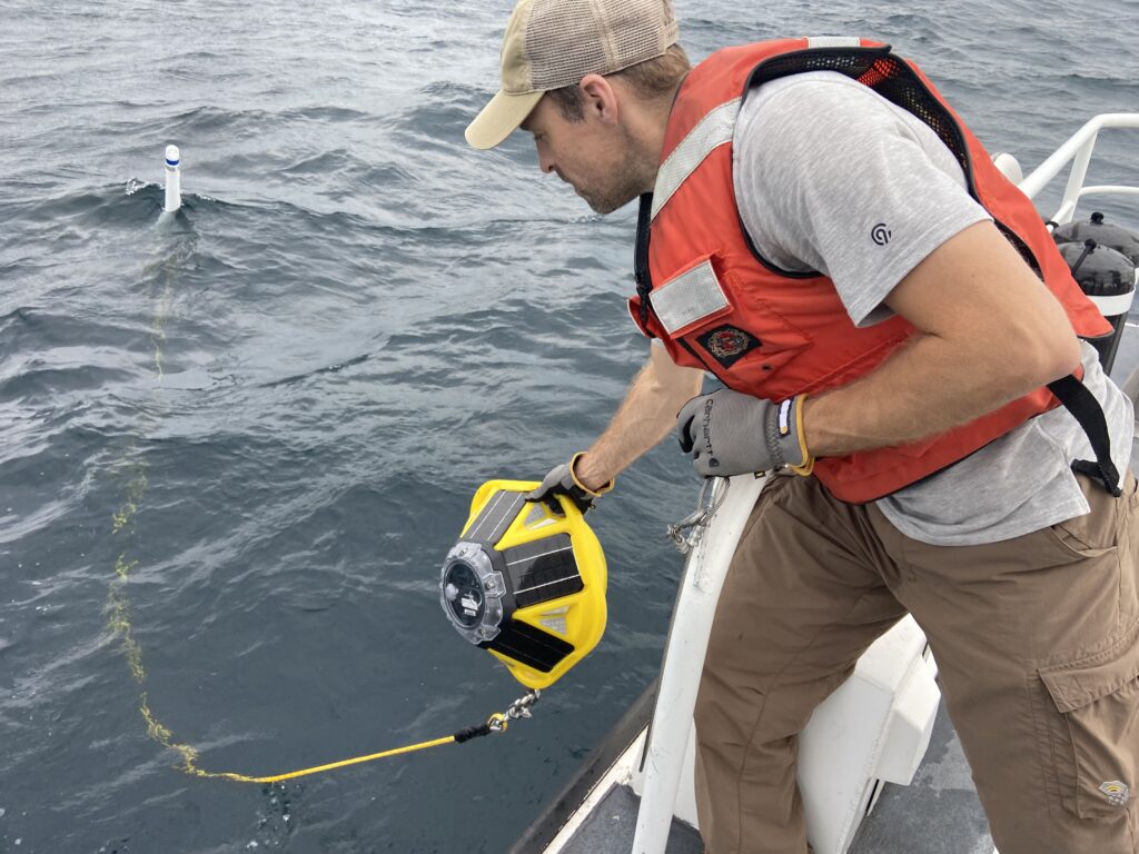
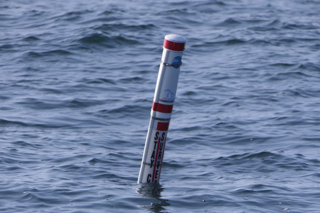
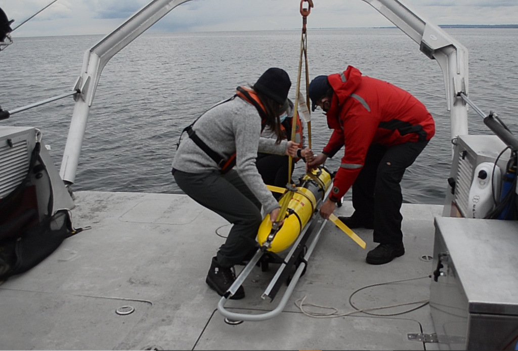
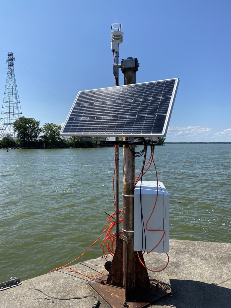
Lake Superior; Improving Solar/Wind Reliability for International Climate Research and Upgrading Coastal Community Buoy Program
Superior Watershed Partnership & Land Conservancy
Carl Lindquist
The Superior Watershed Partnership & Land Conservancy (SWP) in cooperation with Northern Michigan University (NMU) is requesting GLOS mini-grant funding to support and expand climate research at the Stannard Rock Lighthouse and International Climate Research Facility (owned and supported by the Superior Watershed Partnership) and improve the efficiency/effectiveness of the NMU Coastal Hazard Observing System for Southeastern Lake Superior (initially funded by and linked to the Great Lakes Observing System). The project includes improved power capability/reliability and improved data transmission at Stannard Rock Lighthouse to support current and future U.S. and Canadian research needs including NOAA operational priorities. In addition, the project includes deployment of more efficient and cost effective buoy technology and improved data transmission at three near shore locations spanning over 100 miles of Lake Superior shoreline in Michigan’s Upper Peninsula. Combined, these improved observing systems will provide for more reliable long-term data collection for use by the public, safety officials, weather forecasters and international climate researchers/scientists.
See the data:
STDM4 Stannard Rock (Lighthouse)
Upper Maumee Smart Watershed Pilot
Jennifer English
The City of Defiance obtained funding through a Great Lakes Observing System (GLOS) mini-grant to provide installation of real-time sensors for monitoring nutrient levels in the Upper Maumee River at the City of Defiance Water Treatment Plant (WTP).
The data obtained will enable WTP staff to make critical data-driven decisions on when to pump from the Maumee into the Defiance water supply reservoir. In addition, this information will fill important data gaps needed to support the City’s current Source Water Protection Plan (SWPP) and future work to develop its Integrated Watershed Improvement Plan (IWIP)–complementary efforts that are both designed to benefit water quality in the Maumee watershed and Western Lake Erie Basin (WLEB). This project will also provide information needed to help create stakeholder-driven conservation efforts through agricultural and urban-rural partnerships; not only in the Upper Maumee Watershed, but in other parts of the Great Lakes Region. The work in Defiance will serve as a replicable, scalable pilot project for a Smart Watershed approach in the Great Lakes tributaries through civic engagement, ongoing implementation of best management practices and data communication with GLOS. Finally, this project will support the goals of the “Smart Great Lakes Initiative” by strengthening partnerships with other regional stakeholders working to address basin-wide water quality problems in the Great Lakes.
Lake County Ohio Water Quality Sondes
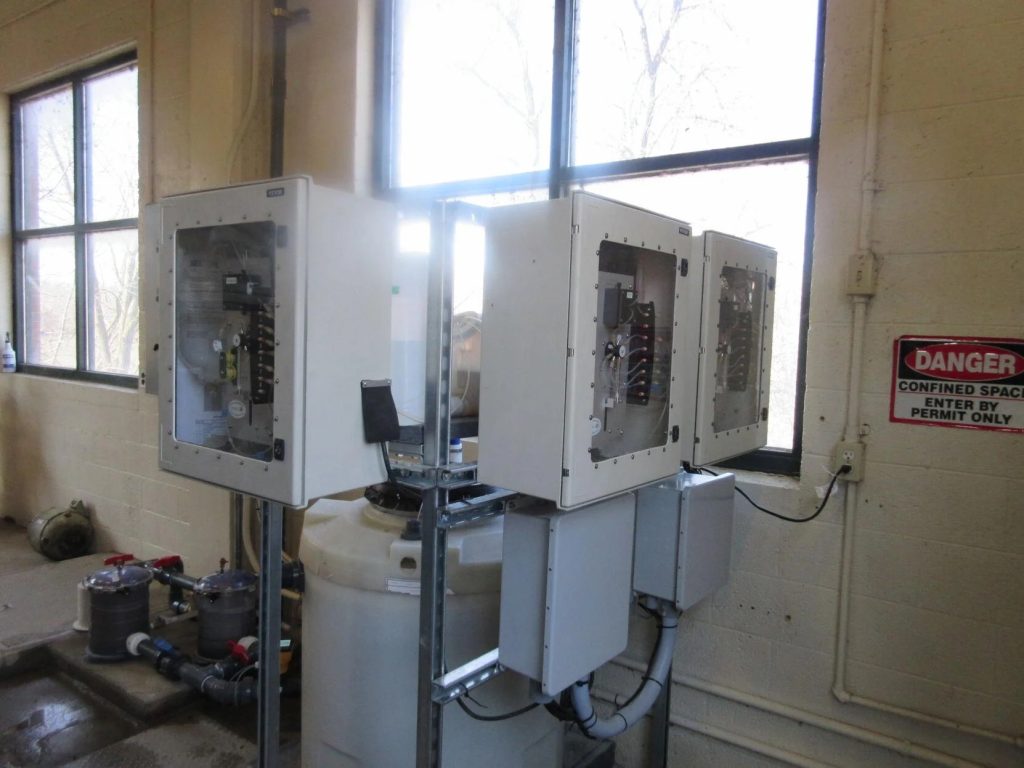
Lake County Department of Utilities
Gary Fedak | Franco Noce | Sandra Vozar
Lake County Department of Utilities, a publicly owned utility in central Lake Erie, owns 2 water treatment plants that experience blue green algae detections and hypoxia conditions. These events affect water quality, monitoring, and treatment. Furthermore, these events and recent
Ohio EPA requirements have changed the way we operate and provide drinking water to our residents. Currently, the raw water quality being pumped into the treatment plants is tested every other hour by grab samples taken by treatment plant operators. The County is seeking funding to provide a sonde with monitoring at each of its two drinking water treatment plants. The sondes will continuously monitor 1) dissolved oxygen, 2) pH, 3) turbidity, 4) total algae, 5) temperature, and 6) conductivity. This will provide an immense amount of data to not only our treatment plants staff but also to the researchers, colleges, industries, recreational users, and other interested parties for years to come. These GLOS linked sondes will provide much needed data which will elevate the understanding of the behavior of the currents, winds, flows, and its effect on Lake Erie’s water quality and will increase the network of information available for the central Lake Erie basin.
See the data:
Enhancing Public Safety, Research, and Environmental Awareness in the Proposed Wisconsin Shipwreck Coast National Marine Sanctuary
NOAA Office of National Marine Sanctuaries | NOAA Great Lakes Environmental Research Lab | Cooperative Institute for Great Lakes Research
Russ Green | Steve Ruberg | Russ Miller
In partnership with NOAA’s Great Lakes Environmental Laboratory and the Cooperative Institute for Great Lakes Research, NOAA’s Office of National Marine Sanctuaries will install three Sofar Ocean smart moorings in the new Wisconsin Shipwreck Coast National Marine Sanctuary. The moorings will transmit via satellite real-time wave and water column temperature information that will directly benefit a variety of Lake users including charter and commercial fishers, recreational boaters, NWS marine forecasters, and researchers. There are currently no observational buoys in this area of Lake Michigan. The project will substantially expand the Great Lakes observing network by deploying new assets in areas that are currently poorly observed and where data is needed to serve stakeholder and lake research needs.
Stories:
“The newest NOAA national marine sanctuary will soon have three buoys” July 27, 2021
See live data:
Extending the NOAA Great Lakes Operational Forecast System and operational wave models to provide real-time coastal flood information for the Great Lakes
Cooperative Institute for Great Lakes Research | NOAA Great Lakes Environmental Research Lab
Thomas Johengen | Yi Hong | Eric Anderson
Coastal flooding within Great Lakes communities poses serious threats to ecosystem and economic sustainability. Providing real-time flood forecasts to communities could provide critical advanced warnings and improve local resilience. ln recent years, NOAA has developed a set of operational models, such as the Great Lakes Operational Forecast System (GLOFS) and Great Lakes Wave Model, to predict water level, current, and wave information at near real-time in the five Great Lakes. However, the modeling domain of these operational systems ends at shorelines and they do not account for wave-driven water levels. Therefore, the existing models are unable to forecast the total water level along the coast, which is the combination of still water level, storm-surge, and wave induced run-up. To overcome these limitations, the proposed project aims to develop a model that combines GLOFS, operational wave models, predictions of wave run-up, and topography along the Great Lakes coast, to provide detailed forecasts of total water levels. This integrative model could be executed automatically at near real-time, to provide predictions of the total water level at shorelines, and potential flooding extent. At the end of the project period, we propose to transition the model to GLOS for implementation into a real-time framework.
Spatial and temporal dynamics of light and temperature in Lake Ontario

Ontario Ministry of Natural Resources and Forestry | University of Toronto Scarborough | Fisheries and Oceans Canada | U.S. Geological Survey Lake Ontario Biological Station | U.S. Fish & Wildlife Service Lower Great Lakes Fish & Wildlife Conservation Office | Queens University
Tim Johnson | Mathew Wells | Jon Milwood | Brian Lantry | Dimitry Gorsky | Bruce Tufts
Temperature and light are critical measures of aquatic habitat that influence physical and biological processes including production across the food web (e.g. deep chlorophyll layer, zooplankton production, fish growth, etc.), habitat preference, and physiological and chemical activity / rates. The metalimnion represents a transition of warmer and generally well mixed surface waters from the deeper and more isothermal hypolimnion. However, the depth and thickness of the thermocline can vary substantially with marked effects on the spatial boundaries for biological production and interactions. We propose to combine vertical temperature and light arrays with existing fisheries acoustic telemetry moorings to describe the temporal and spatial variability in the temperature and light environment at 13 offshore locations in Lake Ontario, chosen to represent different types of bathymetric and hydrodynamic environments. Data will be temporally continuous to capture the dynamics in these influential measures to help researchers interpret spatial patterns in limnological variables (e.g. satellite derived chlorophyll a or whiting events), density distribution patterns from LOPC and fisheries hydroacoustics, as well as inform production and food web models (from primary producers to top predators) that rely on an accurate characterization of the thermal and optical properties.
Enhancing the accessibility of the Heidelberg Tributary Loading program through real-time water quality data and integration into GLOS
Laura Johnson | Jakob Boehler
Understanding tributary inputs to Lake Erie is essential to managing and improving the overall health of the lake. Luckily, high frequency sediment and nutrient concentration monitoring has been on-going for up to 46 years for some tributaries as part of the Heidelberg Tributary Loading Program (HTLP). Although this program has provided very high quality data for decades, the HTLP could be improved and enhanced by the addition of a telecommunication network to provide online, real-time data from water quality sensors. The goals of this project are to connect new and existing water quality sensors to a telecommunication network at all the HTLP sampling stations in the Lake Erie watershed and work with Great Lakes Observing System (GLOS) to integrate both sensor data and the existing long-term sediment and nutrient concentration data into the Seagull platform. By including this data in the GLOS platform, we will be able to link tributary inputs to Lake Erie water quality in new ways and hopefully provide insight into how to improve the health of this vital ecosystem.
See the data: HTLP Rock Creek | HTLP Sandusky River | HTLP Wolf Creek | HTLP Honey Creek | HTLP Portage River | HTLP Unnamed Tributary to Lost Creek | HTLP West Creek | HTLP Tiffin River | HTLP South Turkeyfoot Creek | HTLP Blanchard River | HTLP Potato Run
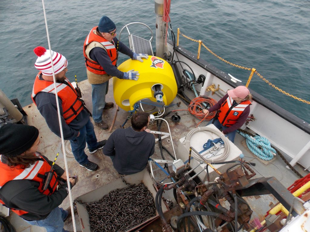
An Expanded Spotter buoy network on the upper Great Lakes in support of recreational boating, shipping, and ferry line operations
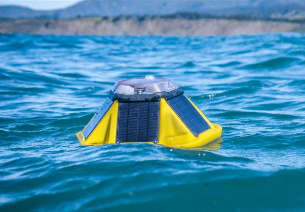
Michigan Technological University | Northwestern Michigan College
John Lenters | Hans Van Sumeren | Andrew Barnard | Erika Vye
The Great Lakes region comprises a vast network of inland seas subject to strong storms, large waves, and changing water levels. Over 150,000 people annually cross the treacherous “Death’s Door” passage to Washington Island, while thousands more make the long haul across Lake Superior to Isle Royale National Park. Despite the need for improved public safety in these heavily trafficked waters, the network of data buoys on the Great Lakes is too sparse to provide relevant information along vast stretches of coastal shoreline. In this collaborative effort between MTU and NMC, we propose to employ “smart” buoy technology to fill gaps in wind and wave observations on Lake Superior and northern Lake Michigan. The buoys will include “smart moorings” to provide information on local variations in water temperature and lake level due to seiches, upwellings, and meteotsunamis. The project team proposes to deploy three buoys along critical transit routes to/from Isle Royale National Park and Washington Island. Real-time data will be disseminated to GLOS on a half-hourly basis, and stakeholder engagement and outreach activities will take place throughout the course of the project.
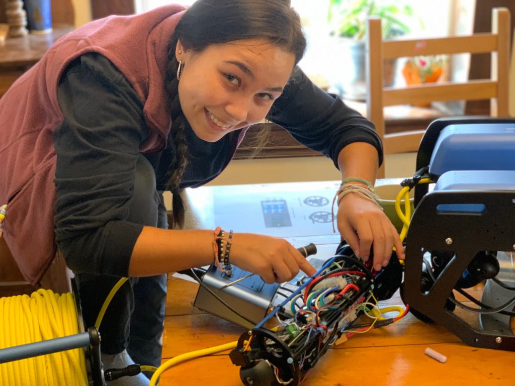
Rapidly Expanding Real Time Water and Weather Observations on the Western Coast of Lake Michigan with the Panther Buoy
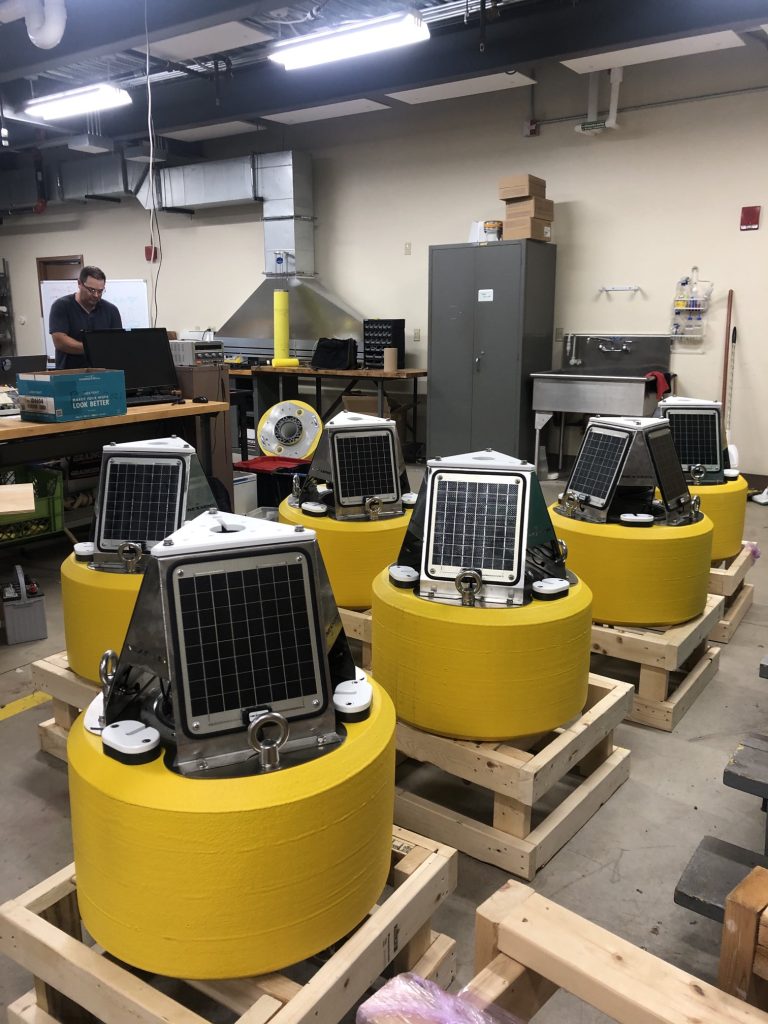
University of Wisconsin-Milwaukee
Todd Miller
Real- time, continuous environmental monitoring buoys provide actionable public health data, information for forecasting weather conditions, and high-resolution observations advancing scientific discovery. However, the high cost and technological expertise required to build, program, and deploy these systems is a barrier to the expansion of real time observations in more locations. To overcome this, we have designed and built a low cost, open source, plug and play smart buoy (i.e. the “Panther Buoy”) on a compact easy to deploy platform. The system provides data logging capabilities, embedded telemetry and a suite of sensors for monitoring at a fraction of the cost of typical buoy systems with no programming skills needed. We seek to use this system to rapidly expand observations in the Great Lakes region. As an initial testbed we will deploy four Panther Buoys in areas of Lake Michigan and Green Bay where currently no real- time observations exist. Data will be sent to GLOS and advertised to local stakeholders including sport fishing and boating organizations along the Wisconsin Lake Michigan shoreline. This project will be a springboard for massive expansion of water and weather observations across the Great Lakes region benefiting natural resource managers, recreationalists and the water economy.
See the data:
Data Platform Expansion and Transition: Huron to Erie Corridor and Watershed

Carol Miller | Yaoxian Huang
The proposed work comes at an especially critical time for the Great Lakes region. The highly publicized Flint Water Crisis revealed that many urban communities, like Detroit, may foster the conditions that contributed to the crisis. In addition, there are ongoing challenges with the prevention and control of algal blooms, harmful pathogens along urban beaches, cost of service for water, urban flooding, and combined sewer overflows (CSOs). Thus, despite progress over the past few years, there remains a crucial need for steadfast and ever-improving source water monitoring, forward-looking water management technologies, and broad-based community engagement and education, that can be provided by Healthy Urban Waters at Wayne State University working in collaboration with partners, such as GLOS. The HUW program is poised to make significant advances in these areas. The project introduced here addresses the goals of the GLOS Smart Great Lakes Mini-Grants program which intends to advance: 1) the development and deployment of smart technologies to improve the monitoring of the ecological health of the Great Lakes, 2) the effective management of data, and 3) the creation of information tools that serve stakeholders’ needs.
See the data:
HW Ira Township | HW Marine City | HW Grosse Point Farms | HW Marysville | HW Port Huron | HW Southwest | HW St. Clair | HW Water Works Park | HW Wyandotte | HW Algonac | HW Monroe
Year-round real-time monitoring of the Lake Ontario nearshore
David O’Donnell
Our project will address spatial and temporal data gaps related to the lack of real-time water quality monitoring of Lake Ontario by adding two year-round nearshore monitoring sites on the southern lakeshore, thus expanding the Lake Ontario GLOS buoy network that currently includes a single water quality monitoring buoy near Oswego, NY. Monitoring platforms deployed at these sites will provide high quality data to a variety of stakeholders, including recreational lake users (e.g., boaters and fishermen), water quality modelers and weather service forecasters. As part of the GLOS network, these data will contribute to the study of long-term water quality trends, including changes related to climate change and aquatic invasive species. Overwinter monitoring of hydrodynamic and water quality parameters will provide valuable insights into water motion, material transport, and water quality changes. During the summer months, surface buoys with meteorological stations will measure air temperature, humidity, wind speed and direction, and solar irradiance. The water quality parameters of temperature, specific conductivity and turbidity will be measured just below the water surface. Overwinter sensors resting on the lake bottom will measure water temperature, current velocity, height, direction and period of waves, and ice thickness.
Stories:
“This researcher is testing a rugged winter monitoring system in Lake Ontario” March 15, 2022
Citizen Science in the Heart of Detroit
University Prep Science & Math High School
Jim Riske | Pamela Sparks | Keith Young | John Lockhart
Citizen Science in the Heart of Detroit seeks to deploy low-cost methods of monitoring water quality and wildlife in the Great Lakes and to do so while integrating students from underrepresented communities in the project design, data collection, and analysis.
Salmon Unlimited of Wisconsin Data Buoy Project
Salmon United of Wisconsin, Inc.
Ronald Wesley
Salmon Unlimited of WI would like to purchase and maintain a real-time data buoy in Lake Michigan near the port of Racine, Wisconsin. Our goals are to provide accurate data pertaining to local marine and weather conditions near our port. Racine, WI is near 2 other buoys that report conditions utilizing GLOS- the Milwaukee Atwater buoy is to our north and Winthrop Harbor to our south. There is often a discrepancy in water conditions in Racine compared to the data reported from these locations. We have some unique underwater structures, as well as Wind Point, that can attribute to these differences. The data from this location could also be used by the Coast Guard and local sheriff patrol boats to help during maritime emergencies.
Stories:
“New Salmon Unlimited buoy begins monitoring waters near Racine, WI” July 19, 2022
Bima’azh (to track along or to follow trail along)
Chippewas of Nawash Unceded First Nation Fisheries Assessment Program | Saugeen Ojibway Nation Environment Office | Collective Environmental Consulting
Ryan Lauzon | Kathleen Ryan | Mary Claire-Buell | Alexander T. Duncan
Over the past two decades, Lake Huron has undergone drastic changes, resulting in the decline of dikameg (lake whitefish; Coregonus clupeaformis) throughout the lake. Dikameg are a socio-ecologically important fish species that play a vital role in the ecosystems of Lake Huron. Since time immemorial, the Saugeen Ojibway Nation (SON) have harvested dikameg for ceremony, trade, and subsistence, developing a strong cultural connection and understanding of this fish species. By applying a two-eyed seeing approach, Bima’azh (to track or to follow trail along) will further our understanding of dikameg habitat and behaviour on a fine spatial scale.
Smart-technology (e.g., acoustic telemetry, remotely operated underwater vehicle), SON-based ecological knowledge, and education will be used to collect and share information on dikameg.
By generating data on the fine spatial scale behaviours, habitat, and movements of dikameg, and by working with the SON, we will obtain a more holistic understanding of dikameg’s relationship to their habitats in the SON Territory and address the SON’s concerns and questions about their decline. Bima’azh will build capacity, assess the status of dikameg habitat, provide an example of two-eyed seeing and smart-technology, and inform decision making to ensure dikameg thrive for another seven generations.
Stories:
“Bima’azh project applies a two-eyed seeing approach to study populations of dikameg or lake whitefish” June 21, 2021
Spatial and temporal resolution of whole-lake metabolism, plankton and fish in the lower Great Lakes using RAEON’s Autonomous Underwater Vehicles
Trent University | Real-time Aquatic Ecosystem Observation Network
Marguerite A. Xenopoulos | Cailin Burmaster
This project leverages affiliations with the Real-Time Aquatic Ecosystem Observation Network (RAEON) from Trent University and the University of Windsor as well as Ocean Tracking Network (OTN), and the Consortium of Great Lakes Gliders to collect high-resolution monitoring data on chlorophyll, temperature and dissolved oxygen in at least 3 of the Laurentian Great Lakes. Objectives for RAEON’s glider program in 2021-2022 include developing sensor technology and survey techniques for acoustic telemetry and hydroacoustics studies in the Great Lakes; monitoring dissolved oxygen for lake metabolism measurements and detection of hypoxia; implementing a binational collaborative network which includes other regional glider observatories (Consortium of Great Lakes Gliders); and contributing robust datasets to the Integrated Ocean Observing System (IOOS) glider Data Assembly Center (DAC) and GLOS’ Seagull application. The novel methods of observation performed by Slocum gliders in the Great Lakes will provide opportunities for scientific presentation at the Joint Aquatic Science Meeting (May 2022, Michigan), preparation of peer-reviewed manuscripts including submission of shallow water operations and sensor integrations methods as well as provide valuable data to the Great Lakes community on water quality.
The REASON (River Environment and Sensor Observation Network) Project: Understanding Ecosystem Change on the St. Lawrence River-Kaniatarowanenneh to Support Community Strategies for Well-Being
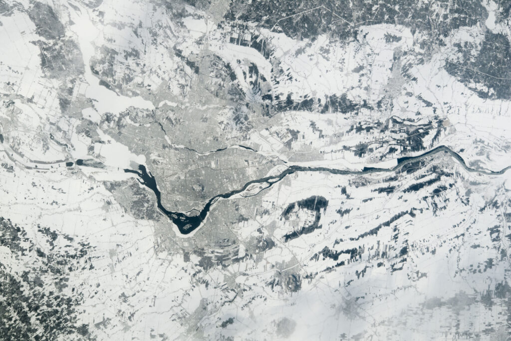
St Lawrence River | Photo by NASA Earth Observatory
Clarkson University | Mohawk Council of Akwesasne | St. Lawrence River Institute of Environmental Sciences
Michael R. Twiss | Abraham Francis | Jeffery J. Ridal
The Mohawk community of Akwesasne is intimately connected to Kaniatarowanenneh (the St. Lawrence River) and responsible for a positive relationship between the community and the river. Past environmental injustices in the region and ongoing efforts to remediate them require creates a need for the Akwesasrenon, the people in this community, to have the ability to collect their own water quality data. Here, the REASON Project approach to placement of flow-though sensor arrays in hydropower dams will to monitor river water quality 365 days/yr in the inlets of the two principal drinking water treatment facilities in Akwesasne. Augmenting these arrays will be an array in the Moses-Saunders hydropower dam, located directly upstream of Akwesasne, and a mobile array used to probe tributary inflows into Kaniatarowanenneh. The outcomes of this project include technology transfer from the REASON Project to Akwesasne, a dataset of water quality independently collected by Akwesasronon, the beginning of a long-term data set of water quality to support the community need for knowledge of the quality of their drinking water source, and strengthened multi-national collaboration and expansion of the REASON Project. This project is taking place in traditional Kanienkehaka Territory. Data sharing will follow Indigenous Data Sovereignty protocols.
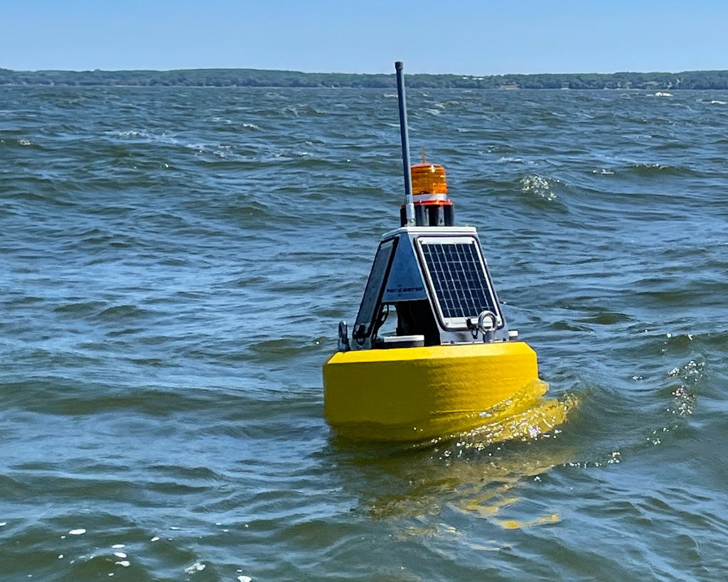
Validating a low-cost, open-source surface wave data logger for real-time drifting or moored marine observations
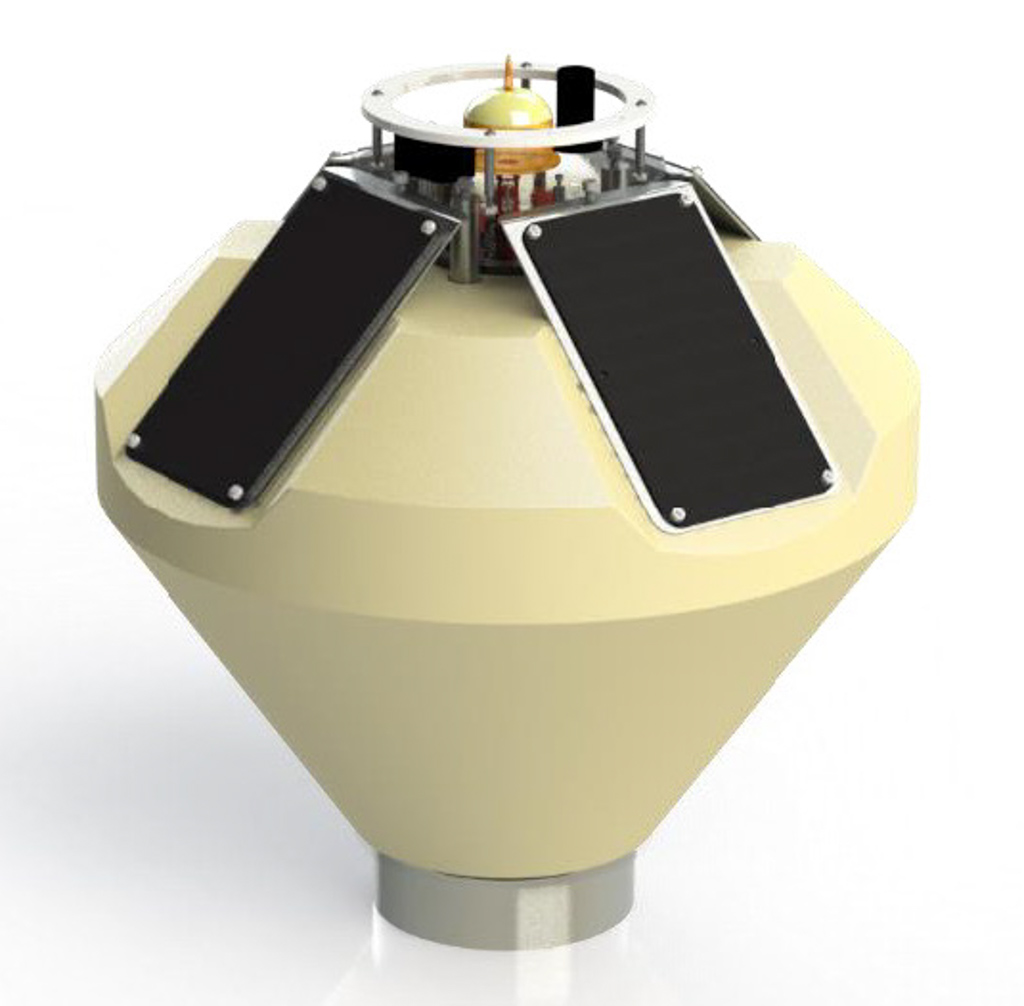
Photo by Craig Hill
University of Minnesota-Duluth
Craig Hill
This project aims to validate ongoing development of a low-cost, open-source wave measurement data logger integrated into a compact observation buoy for both moored or drifting measurements on the Great Lakes. The system and project tests Iridium SBD communications for potentially remote locations on the Great Lakes where other forms of communication are unreliable. Using western Lake Superior as a test bed, instantaneous wave motion measurements and on-board processing producing wave statistics will be validated against industry standard wave measurement technologies, including an NDBC buoy (45027) and subsurface mooring wave measurement sensors. The successful development of this technology will enable accessible and expanded observation systems, in particular, during late season storms when many observation systems have been recovered. The project directly aligns with the GLOS mission to support science, policy, management, and industry in the Great Lakes, and enables new ideas and approaches to integrate additional smart systems, computing and IoT advancements, new sensor integration, and community or K-12 guided observation programs.
Buoy Meets LoRa: IoT Networking and Remote Environmental Monitoring in Green Bay’s Hypoxic-Prone Waters
University of Wisconsin-Milwaukee | University of Wisconsin-Green Bay
Val Klump | Michael Zorn | Jessica Grow
Scientists at University of Wisconsin Green Bay and Milwaukee are developing a partnership with a local cell provider, Cellcom, to develop a series of low cost, real-time sensor arrays for continuous measurement of critical water quality parameters in the Green Bay ecosystem. This array will utilize Low Power, Wide Area (LoRaWAN) networking protocol to wirelessly connect battery operated “things” to the internet as part of a regional environmental sensing network. This project will pilot such platforms and will target hypoxic dead zones in the bottom waters and HABs in surface waters as a demonstration of the potential for such arrays to capture the dynamics of rapidly shifting environmental conditions. “Hypoxic blobs” have been documented to trigger massive fish kills in the past, and evidence suggests that hypoxia is becoming more prevalent and of longer duration in the last decade. Such data may also augment the new GLATOS receiver array being deployed in the bay to investigate the relationship between fish movements and bottom water oxygen conditions throughout the entire season. The current network of LoRa receivers will be expanded by Cellcom to cell towers that will provide coverage that will encompass the entire region where dead zones form.
See the data:
Towards consideration for an Indigenous-directed sister Smart Great Lakes Initiative (I-SGLi)
Trent University | Collective Environmental Consulting
Chris Furgal | Barbara Moktthewenkwe Wall | Mary-Claire Buell
This project proposes to conduct an environmental scan on recent and ongoing Indigenous related research and monitoring projects and initiatives in the Great Lakes. Inclusive of peer reviewed and grey literature, publicly available information on organisational website, and informed through key-informant interviews with representatives of Indigenous Tribes, First Nations and Metis communities and organizations around the lakes, this scan will help inform an understanding of current initiatives and interests among Indigenous peoples in the region regarding Great Lakes research and monitoring needs. Consultation with representatives of Indigenous communities, organisations, and governments around the Great Lakes will then be conducted to identify future research and monitoring goals, interests and information needs. Finally, through consultation with these individuals, an assessment of interests in and needs for engagement in a collective Indigenous-directed sister initiative to the Smart Great Lakes initiative will be documented. Based on the results of these review and survey consultation efforts, recommendations for future initiative planning and development will be identified.
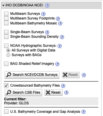
Crowd Sourced Bathymetry in support of Lakebed 2030
Derek Niles
A Crowdsourced Bathymetry (CSB) strategy will catapult data collection in support of Lakebed 2030 by force multiplying the number of vessels contributing to the project at minimum cost to GLOS. By implementing CSB technology, GLOS is able to leverage the organic single beam echo sounders found on various vessels plying the Great Lakes on a daily basis, and gain an additional means of harvesting depth data wherever the vessel of opportunity may sail.
This project will engage private and commercial vessels to collect bathymetric data across all of the Great Lakes concurrently. The ability to capture data from a vast number of sources adds significant value to Lakebed 2030 and immediately contributes to mapping the expanse of the Great Lakes.
This project, as executed by Orange Force Marine Ltd., will also contribute to the Smart Great Lakes Initiative by demonstrating a method of integrating data collected from Vessels of Opportunity (VOO) via Internet of Things (IoT) devices, into the Seagull cloud-based platform in near real-time.
Upon completion of the project, the technology solution will be “commercialized” for broader distribution in subsequent seasons to rapidly increase the amount of data collected in support of the Lakebed 2030 initiative.
Stories:
“Soon almost anyone’s boat will be able to map the lakes” Nov. 30, 2021
“GLOS-funded crowdsourced bathymetry is now live on a public database” Oct. 18, 2022
Field testing and validation of an autonomous digital holographic imaging system for detecting cyanobacterial composition and abundance in Lake Erie
Florida Atlantic University | Michigan Tech. Research Institute | NOAA Great Lakes Environmental Research Laboratory
Aditya R Nayak | Timothy Moore | Malcolm McFarland | Michael Sayers | Steve Ruberg
The primary goal of the proposal is to test a novel autonomous holographic imaging system (AUTOHOLO) – recently developed at Florida Atlantic University – and to generate observations of phytoplankton community composition needed for scientific research and environmental management of cyanobacterial harmful algal blooms (cHABs) in the Great Lakes. The instrument will be field tested in western Lake Erie to detect overall phytoplankton community composition, including cHABs (at all bloom stages) and other co-occurring phytoplankton. The holographic images will be fed into machine learning algorithms to detect cyanobacteria genera and other occurring phytoplankton. The primary objectives of the work include: 1) field deployment in summer 2022 to gather test operational capabilities and to generate baseline information for potential future integration of AUTOHOLO in Great Lakes monitoring networks, e.g., buoys, and 2) data processing/algorithm development and refinement to help facilitate automated species classification/abundance measurements. This project will be used to leverage future funding opportunities to enable eventual AUTOHOLO integration into the Great Lakes observing systems framework.
More on AUTOHOLO and GLOS’ HAB work
Expanding nearshore monitoring capabilities in northern Lake MI in the context of water quality, wave action, nutrients, and Lake Whitefish/zooplankton dynamics
Little Traverse Bay Bands of Odawa Indians
Kevin Donner | Chad LaFaver | Samuel Day
In order to increase long-term monitoring of water quality climate data in nearshore areas of Lake Michigan, Little Traverse Bay Bands of Odawa Indians (LTBB) will deploy a data buoy in Sturgeon Bay to collect water quality samples and wave action data, as well as, install three meteorological stations at three separate northern Lake Michigan beaches. Beginning in 2013, LTBB has conducted beach seine and zooplankton surveys at the three northern Lake Michigan beaches to index young-of-year (YOY) Lake Whitefish and zooplankton dynamics, as well as littoral fish assemblages. Water quality data from the buoy will be combined with data collected from the meteorological stations and continued biological monitoring, to produce a more encompassing view of the limnetic and littoral ecological dynamics and how they influence nearshore YOY Lake Whitefish and zooplankton dynamics.
Real-time phosphate monitoring at the mouth of the Fox River, Green Bay
Sarah Bartlett
The Bay of Green Bay is at the receiving end of the Lake Winnebago/Fox-Wolf River water system and is inundated with phosphorus and sediments loads from its watershed. This eutrophic system feeds cyanobacterial harmful algal blooms and the severity of blooms can have an impact on the bottom water hypoxia. NEW Water has maintained a continuous monitoring station at the mouth of the Fox River for the last two decades, monitoring for several of these water quality parameters (e.g. temperature, dissolved oxygen, and recently chlorophyll). As the transition zone between the Fox River and the Bay, this site would further benefit from the installation of a phosphate sensor. Phosphate is currently being measured with NEW Water’s weekly aquatic monitoring at this location but including this parameter into the current suite of high resolution monitoring would leverage NEW Water’s weekly work. Upgrading the current observing system at this site to real-time and being able to expand the network of high-resolution water quality monitoring in Green Bay is imperative.
Flood Dog
Philip Chatterton
Flood Dog Co. is a not for profit organization dedicated to designing, building, deploying, and monitoring smart devices to collect ground, surface and lake water levels along the Great Lakes.
Flood Dog is seeking a grant to enable a pilot project entitled 42 Flood Dogs which would deploy 42 cellular IoT-connected sensor units across the Toronto Islands. The Toronto Islands is a unique ecosystem, and through its diversity represents so many of the varied environments found along the Great Lakes. The location features a variety of spaces including parkland, schools, residential, and light industrial. The Islands offer wetland habitats for many species of birds, as well as other wildlife. Flooding in 2017 and then again in 2019 threatened this delicate biome and effectively closed a valuable city resource.
The 42 Flood Dogs project will track the data from 42 low-cost sensor devices installed in strategic locations across the Islands every 15 minutes for 12 months. For about one dollar a day per device, they will provide detailed granular water level readings in real time over a secure cellular network. This data will be freely available to government, businesses, educators, researchers, and home owners.
Watch the presentation from the JASM 2022 conference:
Stories:
“This Torontonian is building a sensor network for his home islands” Oct. 14, 2021
See the data: