Huron-Erie Corridor Spill Scenario Tool
Helping water managers make decisions during chemical spills.


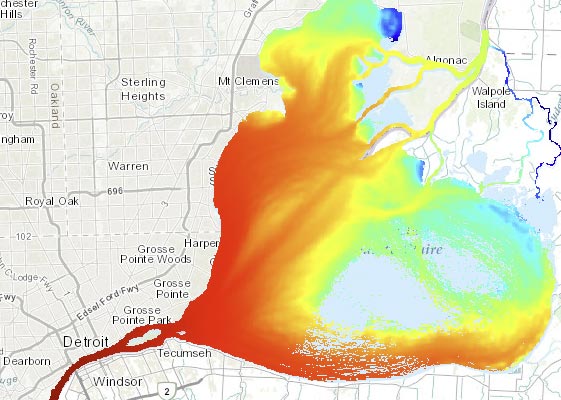
An industrial and shipping hotspot for refineries, factories, and commercial shipping lanes, the Huron-Erie Corridor represents a region especially vulnerable to damage from chemical spills. It is crucial for local water treatment managers to know when such spills threaten areas where water intakes are located.
Together, Michigan Tech Research Institute (MTRI) and GLOS created a web resource to give water managers access to spill models developed by Dr. David Schwab. The app allows users to visualize how likely a spill is to reach them, enabling more informed reactions to spill situations.
As part of ongoing work by GLOS and NOAA Great Lakes Research Laboratory to simulate spill scenarios, this project expanded spill modeling in 2018 to include downstream Lake St. Clair and the Detroit River, developing geospatial model results and creating a user-friendly interface as part of the GLOS data portal.
This resource is one more tool that water managers can turn to when they are faced with making real-time decisions that affect the health of nearby ecosystems and human communities.
Interested in using the Huron-Erie Corridor Spill Tracking Tool?
Logins are available to water treatment professionals and those involved in monitoring or research in the Huron-Erie corridor.
Email support@glos.org to request a login.