Models
Simulating the Great Lakes—past, present, and future.
If you are thinking about going for a swim, but Lake Superior is cold when you dip your toe in, it’s usually safe to say that all the water nearby is also cold.
In the same way, scientific models take on-the-ground observations from platforms like buoys and weather towers and create simulations of lake conditions right now (nowcast), show what happened in the past (hindcast) and even predict the future (forecast).
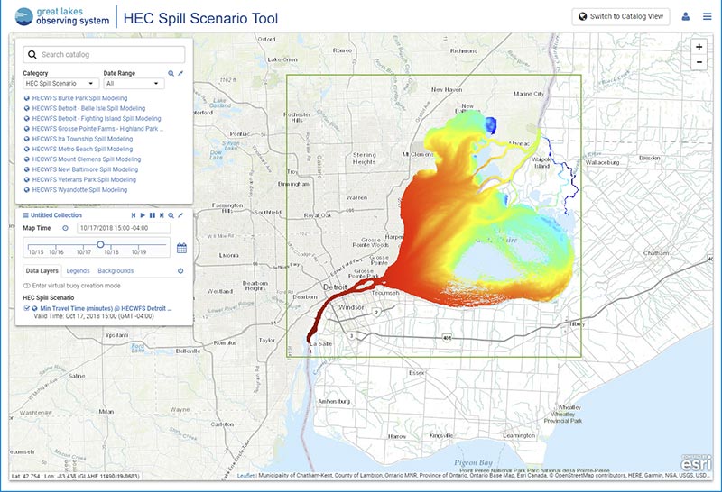
Models give observers lake-wide snapshots to help them boat safely, understand shoreline erosion, know if an area is at high risk from a chemical spill, and more.
Created from complex equations and deep knowledge of the water system, models can be built to simulate:
- Water currents and temperature
- Wave height and direction
- Chemical spills
- And much more

Plan Beach Trips
by checking air temperature and wind or wave conditions

Select a Perfect Fishing Spot
based on temperature predictions

Stay Safe
using warnings from the National Weather Service
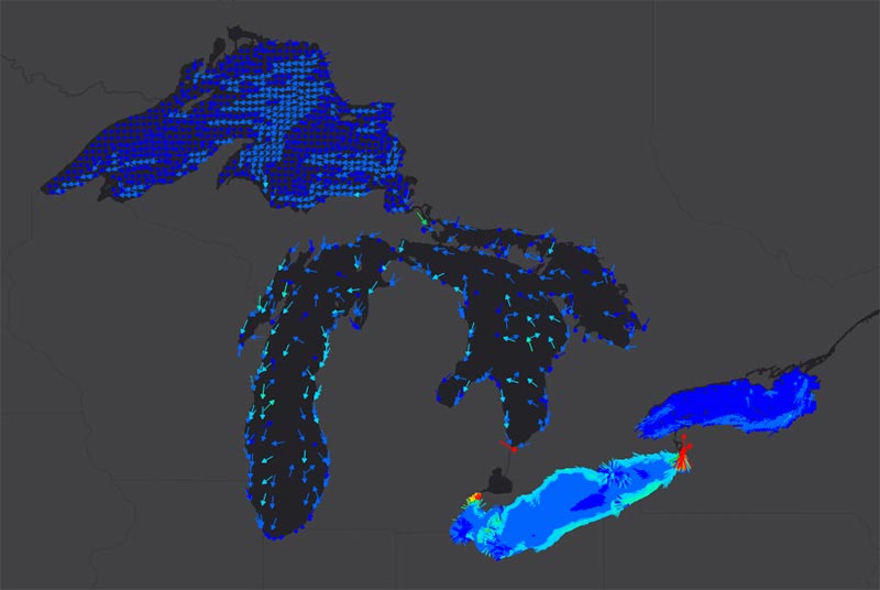
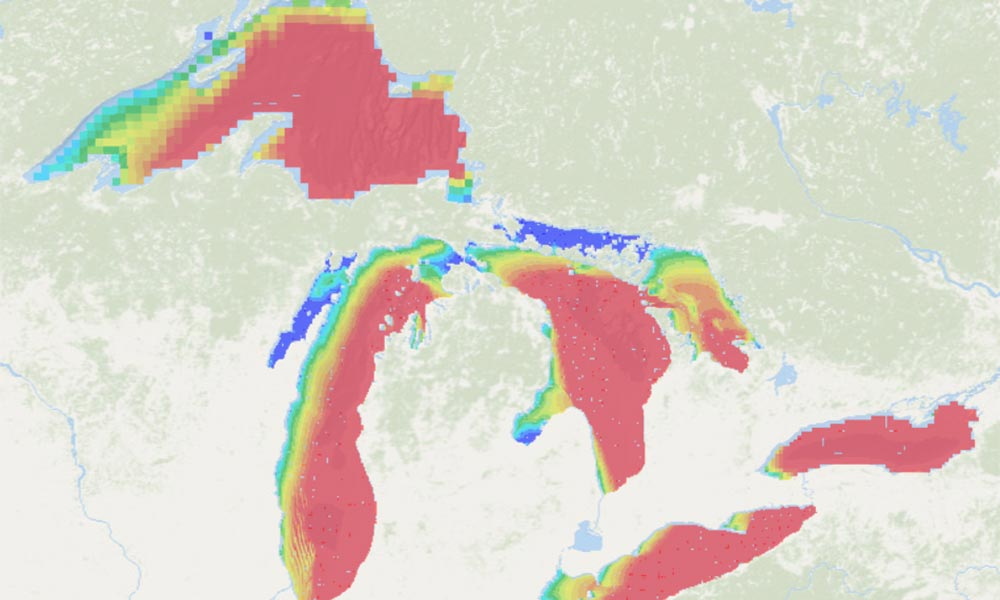
Great Lakes Operational Forecast System
Main parameters: Water currents, temperature, levels, and more.
Operator: NOAA National Ocean Service
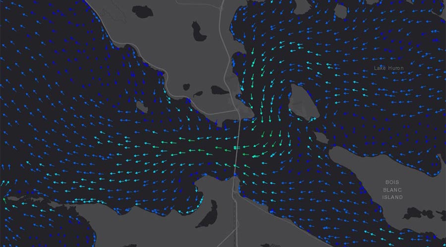
Huron-Erie Connecting Waterways Forecasting System
Main parameters: Particle travel times
Operator: Michigan Tech Research Institute