Data
Find data for your decision. Connect your device or data stream to the observing network.
We support real-time, historical, and predictive observing data from the five Great Lakes and into the watershed.
GLOS supports:
🌊 Physical data about the wind, waves, underwater environment, and more
🧪 Biogeochemical data like chlorophyll, oxygen, and toxins
🐟 Biological and ecosystem data about fish, algae, and more


Data sources include:


GLOS partners with dozens of organizations to maintain the observing network, share data, advance technology, and more.


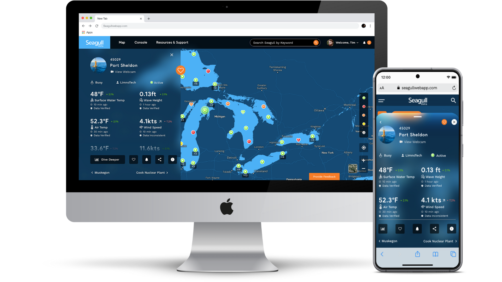
Seagull
GLOS built Seagull to help connect people to the water like never before. A powerful, cloud-based platform, Seagull re-imagines how connected data becomes information and insights in peoples’ hands.

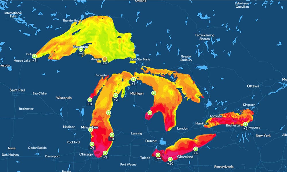
Check Lake Temperature

See Live Waves and Currents

Track Water Quality
GLOS partners with dozens of organizations throughout the region to maintain the observing network, serve data, advance technology, and more.


GLOS offers an IOOS certified access point for real-time observing data. This standardized formatting and quality control system shows others that your data is up to federal standards.

Hundreds of Thousands of Observers

Over 100 Real-time Stations
