Priorities
We want to help advance a more informed and connected region, by putting Great Lakes information into the hands of millions of people.
All of our projects align with our core values, contribute to one or more of our impact areas, and serve to advance one or more of our programmatic initiatives.
Impact Area Priorities


Public Health and Safety
Informed decisions about the tap and the beach
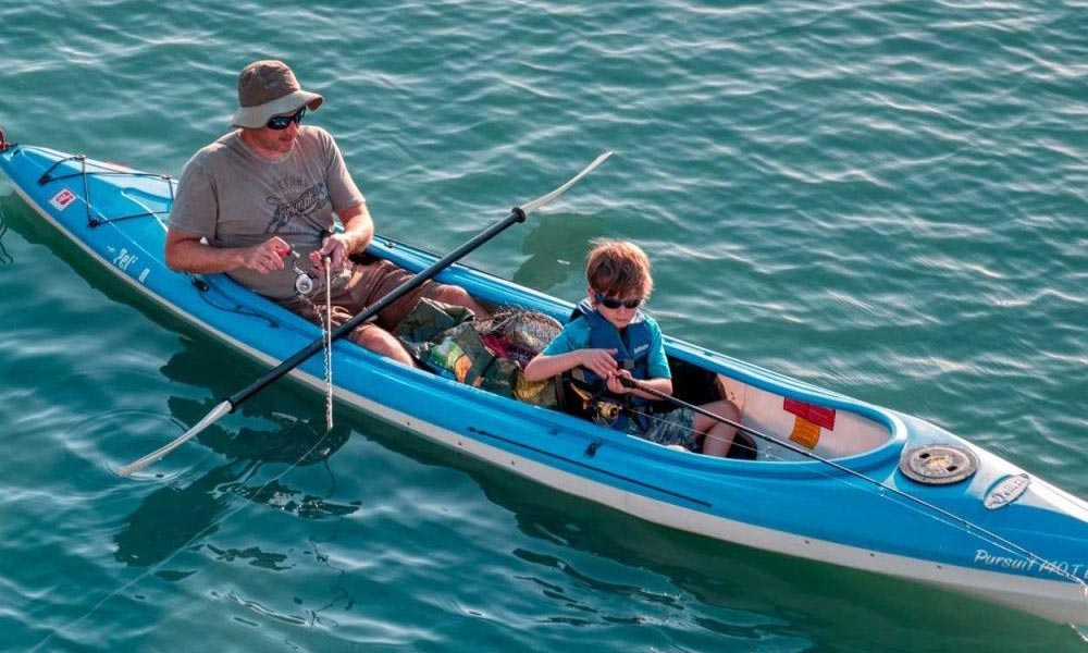
GLOS seeks to improve the livelihood of the over 40 million people who depend on the Great Lakes for drinking water and recreation. When equipped with real-time insights on lake health, observers can protect source waters, enjoy the lakes safely, and improve the health of their environment.
GLOS provides:
- Live information to help predict harmful algal blooms and warn drinking water managers
- Technologies that assist spill response and lakefloor infrastructure mapping.
- Safety information to guide beach closures
- Wind, wave, and temperature measurements for beach goers, surfers, and boaters


Maritime Operations
Awareness on the water
Maritime transportation and recreation are massive contributors to the $6T regional economy. GLOS projects support safer boating, more efficient shipping, and smarter decision making.
GLOS helps:
- Feed critical lake forecast models with data to improve accuracy
- Support decision making for the Coast Guard, the National Weather Service, and local port authorities
- Equip tens of thousands of boaters with information on waves, wind, and water temperature
- Introduce new monitoring technologies to the region for safer, more effective logistics


Climate Resiliency
Monitoring a quickly changing region
People in this region witness climate change all around them, from eroding shorelines and changing ice patterns, to seasonal harmful algal blooms. By monitoring ever-changing lakes and sharing those insights, we help people understand the changes so they can stay safe now and plan for the future.
GLOS enables:
- Data-driven consensus building
- Information sharing across the borders and sectors
- Long-term trend analysis using archived lake condition and ice records


Ecosystem Health
Deep understanding of human impacts
A healthier ecosystem tomorrow means having a deep understanding of the water today. Whether it is via an insight from a buoy detecting a shift in water chemistry, or a fish tag reader registering walleye movements, we help observers understand how to safeguard our delicate regional ecosystem.
GLOS data helps observers:
- Pinpoint ecosystem stressors like changing water levels and hypoxia
- Track nutrients entering the lakes to protect water quality
- Understand water dynamics in areas of concern (AOCs)
- Measure the results of restoration projects
Programmatic Initiative Priorities
Smart Great Lakes
Understanding the lakes together
Today, the region has an opportunity to be more connected than ever. The Smart Great Lakes Initiative (SGLi) organizes the region’s technology ecosystem and network of partners around common policy goals to:
- Improve monitoring, data management, and analysis
- Advance research
- Spur technology innovation
Seagull
An information technology platform for the Great Lakes
GLOS has built a cutting-edge, information technology platform called Seagull to enable access to Great Lakes data, deliver live information on the lakes, and make it easy for others to connect devices and data streams.
Seagull will enable observers to:
- Easily connect a device or data source and share it with thousands of other people
- Track their buoy, sensor, or other observing platform in real-time
- Understand the data and make informed decisions using search, a beautiful map, and simple visualizations


Lakebed 2030
Modern mapping of the Great Lakes
The Great Lakes have never been mapped in detail. Current maps are often created using outdated and and low-density data, meaning it has very few measurements taken over large areas. High-density mapping is critical for effective management, research, and innovation, GLOS is helping to lead Lakebed 2030.
A high-density map can help:
- Monitor lakefloor dynamics to keep drinking water safe
- Discover and preserve thousands of lost or unidentified shipwrecks
- Track erosion and other climate change trends to keep infrastructure safe