Within the interconnecting waterways of the five Great Lakes, there is one other lake that often goes unnamed – Lake St. Clair. Located between Lakes Huron and Erie, Lake St. Clair is an important throughway for transiting vessels and has binational borders.
Great Lakes researchers and managers deliver monthly water balance reports, and Lake St. Clair has raised some questions for these experts who are trying to reduce the uncertainty in the water balance. Evaporative losses from the lakes can be significant, but they are rarely measured and contain significant uncertainty on their own. Furthermore, there have been limited real-time platform deployments to help improve these types of calculations. To address the questions, about three years ago, the U.S. Army Corps of Engineers (USACE) decided to deploy two buoys designed to collect data to help constrain the water budget for Lake St. Clair. The cutting edge of evaporative measurements typically require very expensive instrumentation and highly specialized training to interpret. The USACE seeks a lower cost solution that provides some way to estimate evaporation or validate models that estimate evaporation.
The first of these buoys – the deeper of the two – is the Lake St. Clair Deep Water Buoy, or LSCDB. It is located at approximately the 20-foot contour in the southeast part of the lake, still in United States waters. It provides near real-time measurements of precipitation, solar irradiance, water temperature at multiple depths, and statistical wave parameters. Most buoys that measure irradiance focus on shortwave, downwelling radiation, which is light from the sun in the visible and near-ultraviolet wavelengths (between about 0.1 and 2 micrometers). LSCDB measures all components of it – including what is coming from the sun (downwelling) and what is being reflected (upwelling), as well as shortwave radiation (0.1 – 2 micrometers) and longwave or infrared radiation ( 5 – 25 micrometers). Combined together, these measurements help Army Corps scientists to better constrain the water balance for Lake St Clair.
The second – you guessed it – is the Lake St. Clair Shallow Water Buoy, or LSCSB. It measures the same parameters as the LSCDB but without the wave sensor. It is located in approximately 10 feet of water in the northwest portion of the lake.
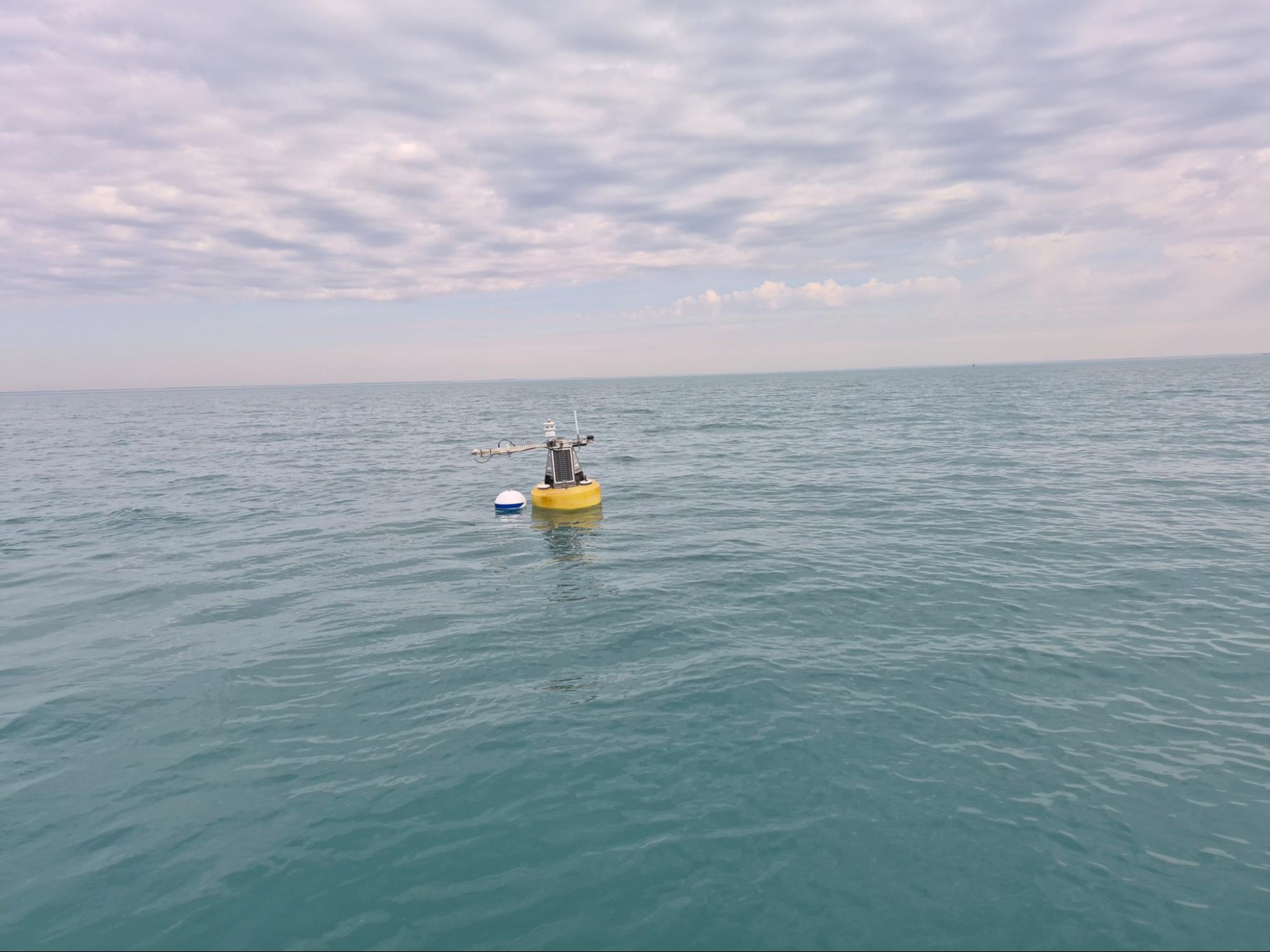
The Lake St. Clair Deep Buoy has enhanced solar irradiance measurement capabilities on the horizontal arm extending above the
solar panels. Photo by Jonathan Wadell, USACE.
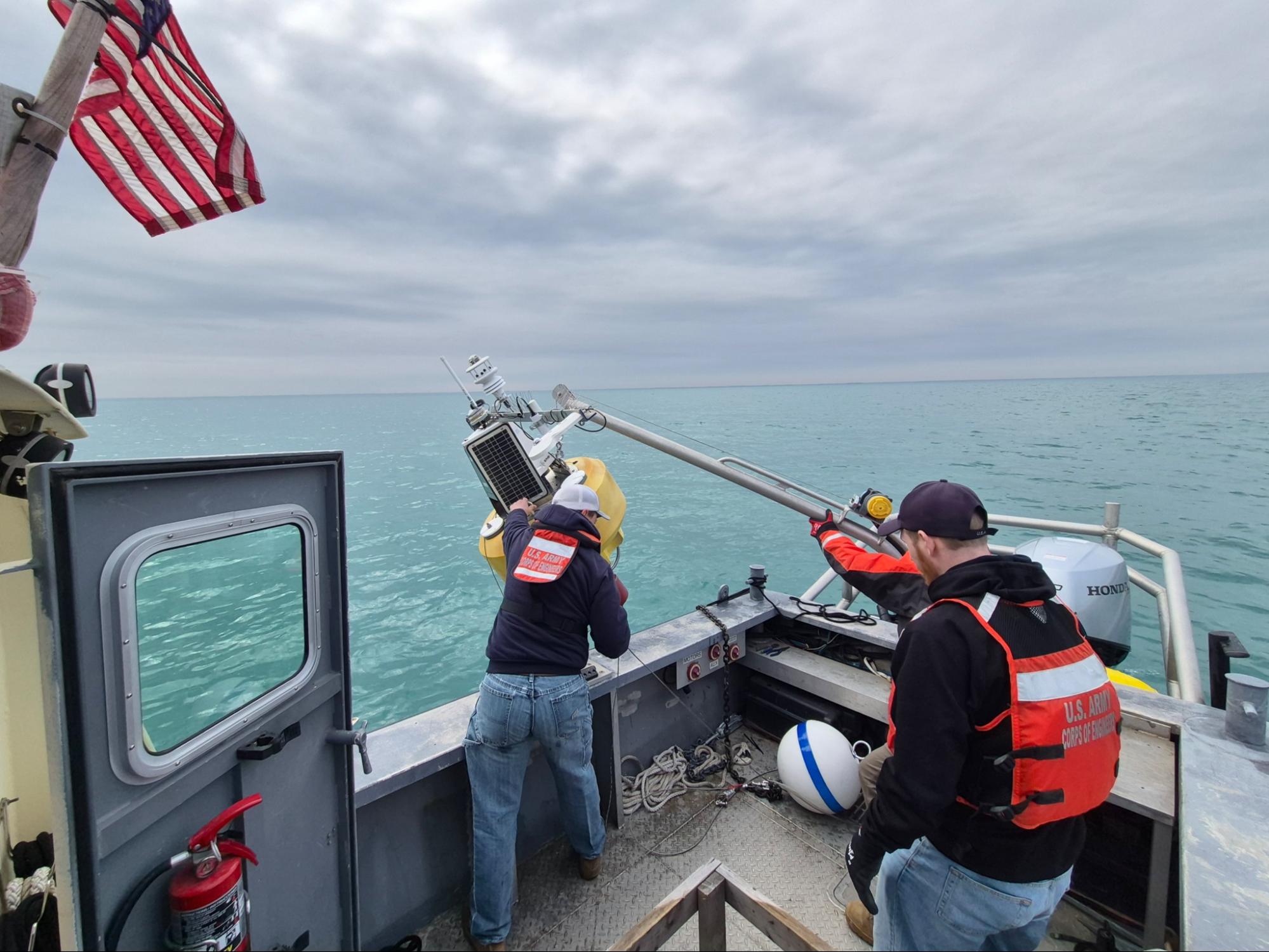
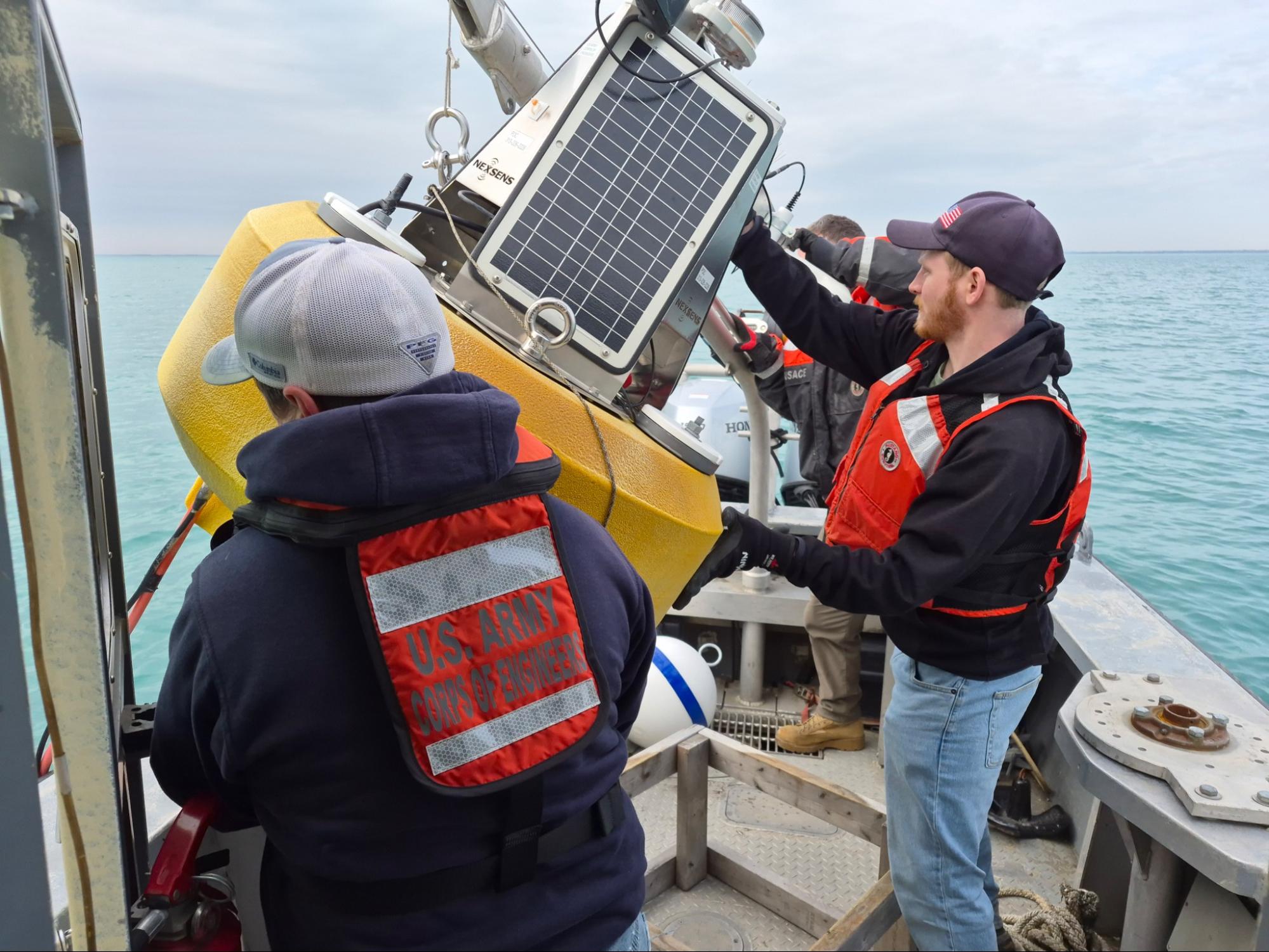
A hard-working USACE crew deployed the deep Lake St. Clair buoy on March 31, 2026. Photo by Jonathan Wadell, USACE.
Did you know?
Estimating evaporation from lakes frequently makes use of pan tests. Pan tests integrate several meteorological variables such as temperature, humidity, wind, etc to estimate evaporation from a nearby lake. Water is put into a standardized pan to a known depth and the depth is measured approximately 24 hours later, taking into consideration any precipitation. These lakes are typically modest in size. Such approaches are difficult to scale up to an entire lake, of any size. It is impossible to scale this approach to the Great Lakes, including Lake St Clair, due to complex thermodynamics and spatially variable meteorology.
These buoys, along with data from downscaled global circulation models, will allow us to apply empirical equations across the lake, taking into consideration changes in internal thermodynamics of the lake due to varying depth.
Many equations exist to estimate evaporation. Some equations require rarely collected data and others rely on readily available data. The goal of this work is to use buoy-measured incident and reflected solar radiation data to estimate evaporation using an “energy budget method”. Then, other simpler evaporation calculations can be compared to this “energy budget method” results to help estimate evaporation uncertainty over Lake St. Clair. These other methods are useful because they could be applied during the spring and fall seasons when the buoys are not deployed. After getting a better handle on evaporation estimates, researchers can determine how they can be used to close Lake St. Clair’s water balance.
by Shelby Brunner – Science and Observations Manager, GLOS
with contributions from
Tim Calappi – USACE
Jamie Ward – USACE
photographs by Jonathan Wadell – USACE.