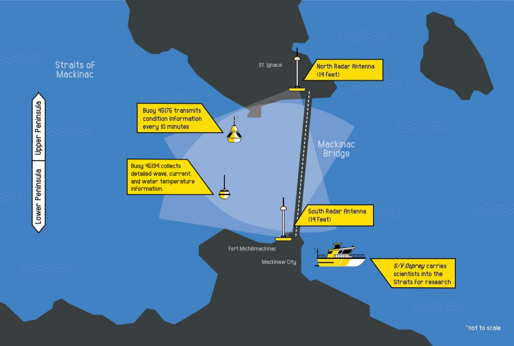
After years of planning, COVID delays, and assorted setbacks, a high-frequency radar (HFR) pair is now installed in the Straits of Mackinac, thanks to work by researchers Lorelle and Guy Meadows at Michigan Tech.
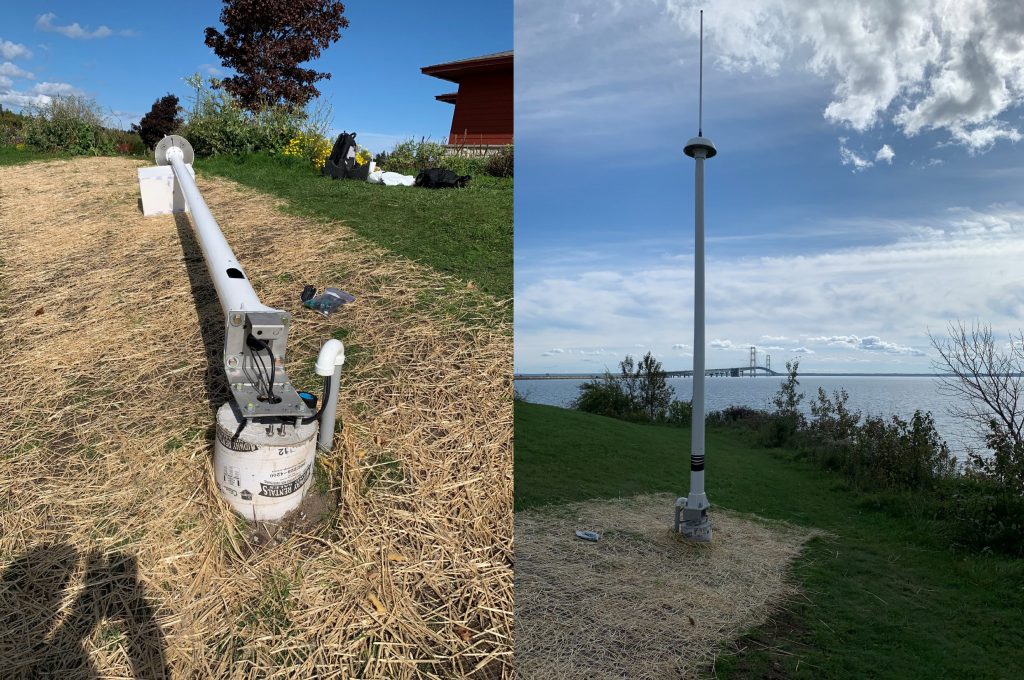
This is the first HFR installed in the Great Lakes. It will provide a map of surface currents every hour to support:
- Navigation and boater safety
- Search and rescue operations
- Spill response
“Being able to use remote sensing to measure real time surface currents over roughly a 10 square mile area in the Straits of Mackinac is an important regional accomplishment,” says Ana Sirviente, GLOS Chief Technology Officer. “The narrow channel between Lakes Michigan and Huron sees strong oscillating currents in an area with pipelines underneath and heavy shipping traffic.”
Learn more about HFR technology.
Data + Info ObservingHF RadarLake HuronLake MichiganMaritime OperationsObserving PlatformsPublic Health and Safety