
Continuing to reflect on 20 Years of GLOS, we met with Lorelle Meadows, retired Physical Oceanographer, who specialized in air-sea interaction and freshwater high frequency radar. Throughout her career, Lorelle was instrumental in early research, development, and adoption of High Frequency Radar systems in the Great Lakes.
“Through the hard work and effort of a lot of people in the Great Lakes region, IOOS included a Great Lakes Regional Association, giving us GLOS. That shifted the way that the federal government and partners around the country and around the world thought of the value of the Great Lakes.
It’s huge for anybody who works in the Great Lakes, to have that voice out there advocating for the development of the systems that we need in order to understand this region so well.”
Lorelle Meadows
Physical Oceanographer (ret.)
NOAA GLERL,
University of Michigan,
Michigan Technological University
Can you tell us a little bit about your background, your education, and professional experience?
Lorelle:
“I grew up in the Great Lakes region, just outside of Detroit, near Lake St. Clair. I grew up loving the water and loving computers, and when I got to the University of Michigan as an undergrad, I figured I could put those two things together. I ended up pursuing my undergraduate degree in Oceanic Science. After that, I went straight for my master’s and took a research position at the NOAA Great Lakes Environmental Research Lab for a couple of years. While I was there, I worked with folks in the current measurement group. I helped with collecting and analyzing data to support model development for the Great Lakes circulation model. I was there a couple of years, and I was really encouraged by my colleagues to go back to school and get my PhD.
I went back to Michigan as a researcher and began pursuing my PhD at the same time. I started working on a High Frequency Radar project and it became obvious that this cutting edge research could become my PhD project.”
How did the High Frequency Radar in the Great Lakes get its start?
Lorelle:
“The concept of bouncing electromagnetic waves off the water surface started in the 60s. It used to be called “over-the-horizon” radar because of the way the electromagnetic waves would couple with the sea surface; you could detect things so far out beyond the horizon. It was a really valuable tool that was used in defense – where many of our research tools begin. It ended up that the technology was pretty well developed and was found to be useful on ocean coasts.
In the late 90s, the Episodic Events Great Lakes Experiment (EEGLE), funded by National Science Foundation, was starting up and offered an opportunity to pilot test a new multi-frequency coastal radar (MCR) that was being developed at the University of Michigan. The system had four different frequencies to test on freshwater. Most of the coastal radars, developed at that point, were just single or maybe two frequencies. It turned out that it was really valuable to be able to test four frequencies simultaneously to map currents on the water surface and see which frequencies worked best on freshwater and under what conditions.
Over freshwater, the electromagnetic waves don’t couple as well with the water surface due to the reduced conductivity of freshwater compared to seawater. As part of the EEGLE experiment, we learned that being close in elevation to the water surface was better for HF Radar in the Great Lakes, which is why you see the recently installed systems are very close to the water surface.
After I got my PhD, I continued to work on HFR. We were using data from the ocean coasts, as well as the data that we had collected in the Great Lakes, and so, there was a continuous development of different tools and uses for HF Radar. The radar was originally developed for oceanographic applications to map currents on the water surface, but it turns out the radar bounces really nicely off of hard targets like ships and ice. Because of the way it interacts with the water surface and the way the currents change, you can also deduce information about the waves and the wind. It was a rich field for research and development.”
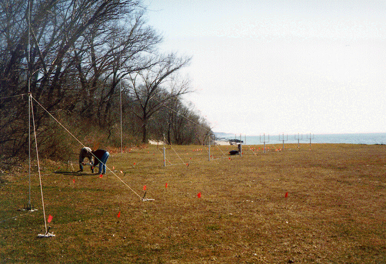
Lorelle and a colleague working on the MCR at Benton Harbor, MI. Courtesy of Lorelle Meadows
Lorelle:
“So the MCR that we built was what’s called a phased array. It had 8 antennas, and they were a little bit taller than me. They had a hoop and a pole, and we would set those up and direct them out at the water surface. We had an antenna to transmit different frequencies of electromagnetic radiation over the water surface and then this array would pick up the back scatter off of the water surface and create a map of the nearshore currents. It was a big system.”
High Frequency Radar (HFR) history in the Great Lakes
as summarized by Lorelle Meadows
- 1997-2001 – HFR in the Great Lakes begins with the NSF Episodic Events Great Lakes Experiment, a large scale experiment that included testing a multi-frequency system, developed at University of Michigan near St. Joseph/Benton Harbor on Lake Michigan, with promising results
- 2002 – Lorelle earns PhD using data from Monterey Bay, California, to establish broader capabilities for HFR data extraction
- Mid-2000’s – Lorelle gives invited presentations on Freshwater HFR for Great Lakes regional stakeholders
- ~2005 – Data management and distribution system for all U.S. HFR systems developed by IOOS
– IOOS skeptical about the utility of HFR for freshwater applications due to limited range of commercial systems over freshwater basins
– Jen Reed advocates for Freshwater HFR to IOOS - 2010 – Lorelle joins the IOOS National Surface Current Mapping Initiative, Freshwater Tiger Team to represent HFR and Great Lakes interests
- 2011 – NOAA/IOOS via GLOS funds an experiment to test a commercially available (CODAROS Seasonde) HFR system over freshwater, specially tuned to Great Lakes conditions at Point Betsie, MI – again promising results
– HFR remains on GLOS annual requests - 2016 – Kelli Paige asks Lorelle to participate in HFR Working Group – not able due to new job as Dean – Rebecca Pearson participates instead
- 2018 – HFR in Straits included as part of IOOS budget
- 2022 – HFR installation and dedication ceremony in the Straits of Mackinac
What are some of the major milestones in your work? Is there anything of which you are particularly proud?
Lorelle:
“Having a Great Lakes HF Radar show up on the national network map for HF Radar. I specifically remember the day I went to the National HF Radar website. I pulled it up and there is the whole big map of the United States. It has the Pacific islands and it has Alaska. I’m looking on this map and there’s this one little icon right at the Straits of Mackinac. It really made me proud!
In addition to finally having HF Radar here, I think one of the biggest game changers for Great Lakes research was the start of the NDBC buoys in the Great Lakes – having that data available to then build on the modeling that was already happening. That was a tipping point for Great Lakes data – and the point where I, as a newly minted scientist, stepped into this flowing river of data that was just starting to come in. To be a part of the work at NOAA GLERL, at the time when they were doing the modeling and developing, was really rewarding. It was really a change maker for Great Lakes science.
That grew into a better understanding of what was happening in the middle of the lake. Then, the question became ‘what’s happening around the edges?’, and that’s where our coastal surveying began, with the development of the coastal buoy network, which was another huge shift. And, right now, the coastal buoys along with the HFR in the Straits helps to support our understanding of one of the most complicated areas of the Great Lakes.”
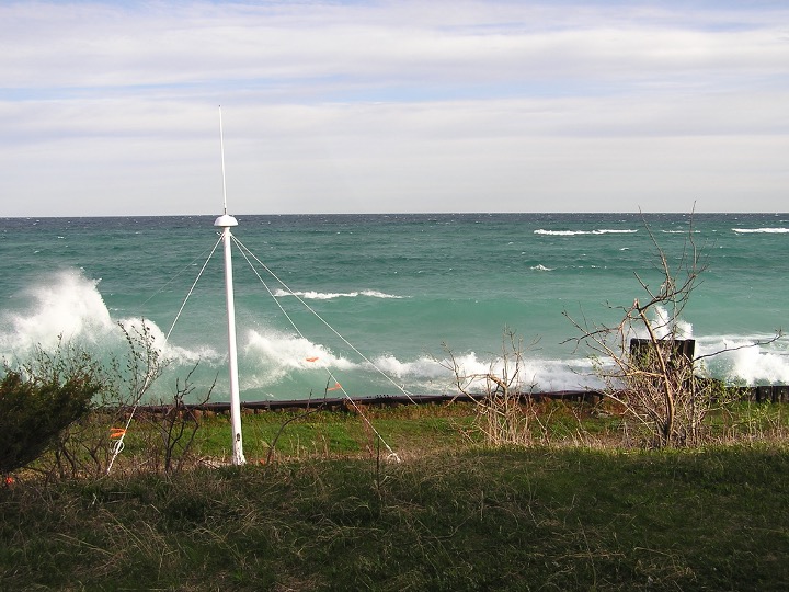
CODAR Seasonde at Point Betsie (Lake Township, MI). Courtesy of Lorelle Meadows
How has GLOS/IOOS best supported this work?
Lorelle:
“Prior to the development of GLOS, there was this sense outside of the region that the Great Lakes were little ponds, and that our work didn’t really matter in the grand scheme of things, making it really hard to get funding.
Through the hard work and effort of a lot of people in the Great Lakes region, IOOS included a Great Lakes Regional Association, giving us GLOS. That shifted the way that the federal government and partners around the country and around the world thought of the value of the Great Lakes. We have a huge coastal network and one regional association covering eight states and two Canadian provinces. It is a great thing that connects us all and brings that recognition to the area. It’s huge for anybody who works in the Great Lakes, to have that single unified voice out there advocating for the development of the systems that we need in order to understand this region so well.”
Is there a particular GLOS program that strikes you as significantly impactful?
Lorelle:
“The buoys. The coastal buoys that GLOS supports. I think the beautiful thing about those systems is that they’re so used by so many stakeholders in the Great Lakes: the fishermen, boaters, the merchant marine, the Coast Guard. You have so many different stakeholders who are accessing those coastal buoys so regularly, everywhere you go. I think that is one of the things that GLOS supports that has a huge impact on a wide group of stakeholders.”
How do you see the observing network evolving, growing, and changing?
Lorelle:
“The easy answer to that question is you have more HF Radars! Thinking of other sites… any place where understanding the currents is going to be important, for example water intakes, busy places where shipping occurs, and pieces of infrastructure that are important to maintain and keep safe.
One strength of GLOS is its capacity for reaching out to regional stakeholders and saying ‘we have this great data system, but is this what you need? How can we make it better for you?’ To make sure that, for example, the next version of Seagull is structured for people who aren’t as knowledgeable of the systems and of the data and to also fill data gaps identified by those stakeholders – to help them see personal and local value in the work of GLOS as they struggle with what is happening on their portion of the coast and region of the Lakes.”
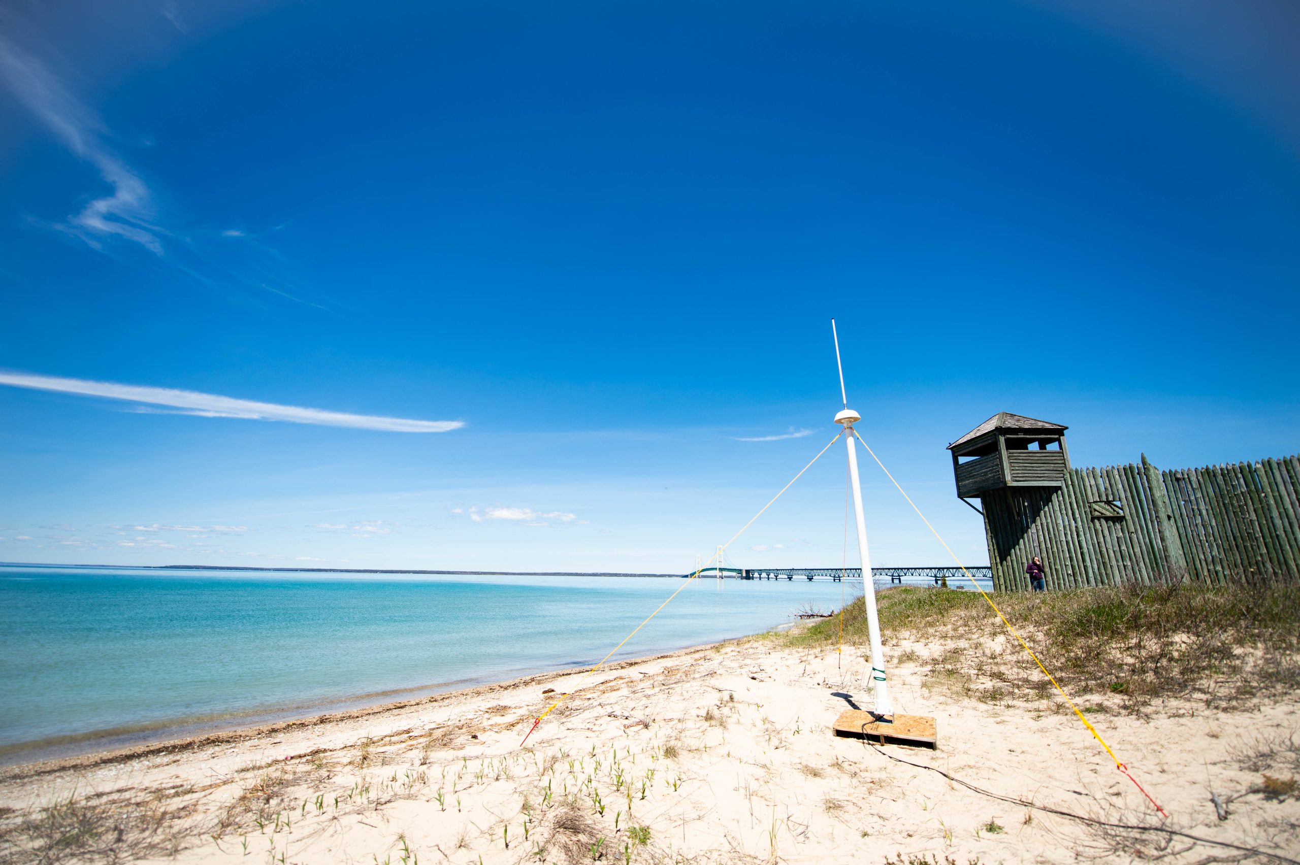
A test installation of a high frequency radar unit in the Straits of Mackinac. Photo by Nathan Shaiyan, Michigan Technological University
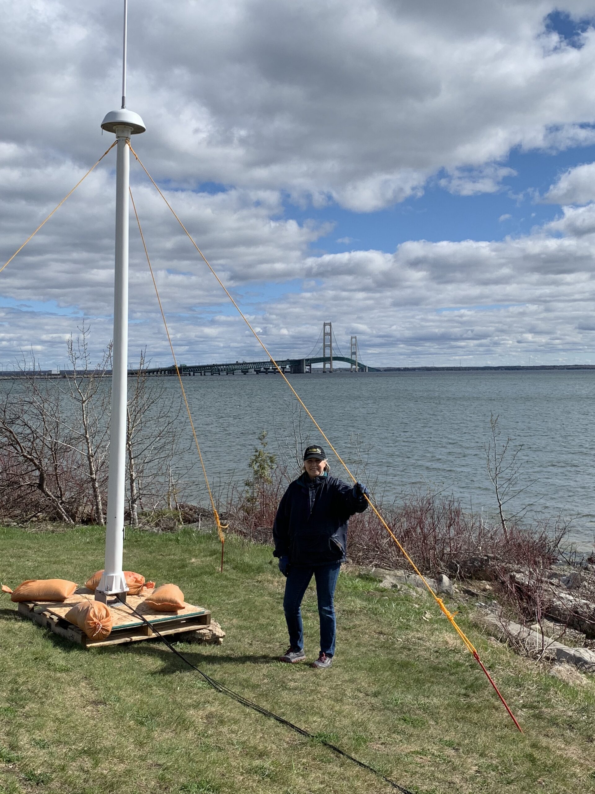
Lorelle Meadows with HF antenna at the (future) north site of the HF Radar at the Straits of Mackinac during the pilot test. Courtesy of Lorelle Meadows
When did you retire? What do you do with your time now?
Lorelle:
“I retired in 2021.
At that time, we were still working remotely. I handed things over to the folks at the Great Lakes Research Center at Michigan Technological University to carry on, and then phased out my retirement, keeping an appointment as a research scientist to finish out some research work that I was doing on engineering education.
I’m actually officially retired at this point, and I am spending my time enjoying these Great Lakes – spending as much time as I can out there on the water: paddling, boating, whatever we can do. We live up in the Upper Peninsula (Michigan), on the tip of the Keweenaw Peninsula on a small inland lake that communicates with Lake Superior. So, we have quick access right out to the big lake.
We finally get to enjoy it without having to measure it – although I will say that I still tend to look for clues in the water and on the beach and analyze everything I see happening out there!”
