Programmatic Initiative Priorities
Smart Great Lakes
Understanding the lakes together
Today, the region has an opportunity to be more connected than ever. The Smart Great Lakes Initiative (SGLi) organizes the region’s technology ecosystem and network of partners around common policy goals to:
- Improve monitoring, data management, and analysis
- Advance research
- Spur technology innovation
Seagull
An information technology platform for the Great Lakes
GLOS has built a cutting-edge, information technology platform called Seagull to enable access to Great Lakes data, deliver live information on the lakes, and make it easy for others to connect devices and data streams.
Seagull will enable observers to:
- Easily connect a device or data source and share it with thousands of other people
- Track their buoy, sensor, or other observing platform in real-time
- Understand the data and make informed decisions using search, a beautiful map, and simple visualizations
Lakebed 2030
Modern mapping of the Great Lakes
The Great Lakes have never been mapped in detail. Current maps are often created using outdated and and low-density data, meaning it has very few measurements taken over large areas. High-density mapping is critical for effective management, research, and innovation, GLOS is helping to lead Lakebed 2030.
A high-density map can help:
- Monitor lakefloor dynamics to keep drinking water safe
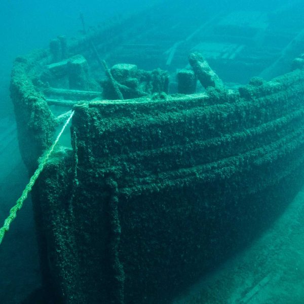
- Discover and preserve thousands of lost or unidentified shipwrecks
- Track erosion and other climate change trends to keep infrastructure safe
Projects
GLOS projects seek to boost the resilience of coastal communities, economies, and ecosystems, by developing tools to put actionable information in the hands of more people for decision-making, and increase the shared understanding of climate-induced coastal impacts to the Great Lakes.

