By Xiaofan Zhang, GLOS Cyberinfrastructure Data Analyst Intern in 2021
Originally published on the Great Lakes Bottom Mapping Working Group
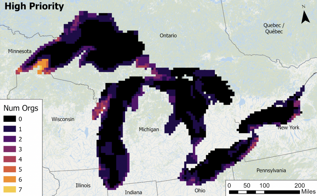
In order to better understand the areas of greatest need for bathymetric mapping, GLOS recently completed a prioritization analysis.
Starting in 2020, with support from the Great Lakes Restoration Initiative (GLRI), GLOS partnered with the Interagency Working Group on Ocean and Coastal Mapping (IWG-OCM) and Bottom Mapping Working Group (BMWG) to assess regional needs for improved bathymetry, lakebed habitat, and other indispensable data.
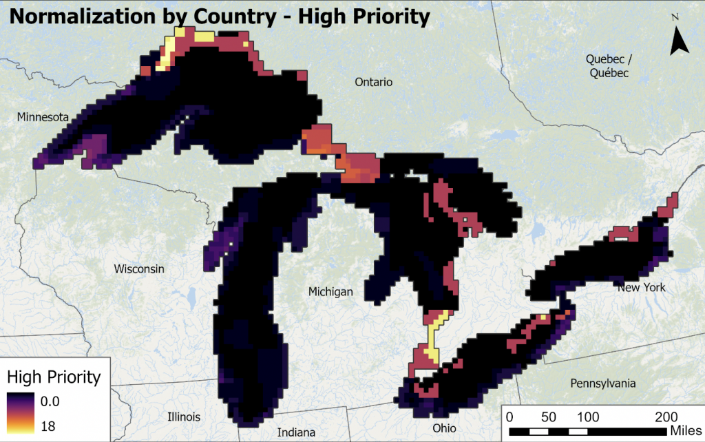
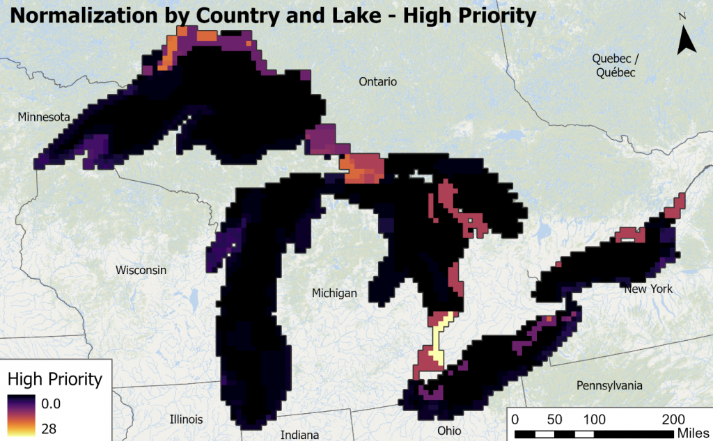
39 organizations joined a participatory GIS developed by NOAA’s National Centers for Coastal Ocean Science (NCCOS), which allowed participants to vote on preferred data collection. Organizations included conservation authorities, universities, coastal management organizations, and others, from both Canada and the US. This group represented the main stakeholders who will benefit from an integrated collection of Great Lakes bathymetry. Once the survey results were collected, GLOS performed necessary data adjustments and eliminated any bi-national and lake-by-lake imbalance.
The results are available via SeaSketch.
GLOS is now comparing the prioritization with existing bathymetry as part of a gap analysis in order to publish a listing of the areas of greatest need to help inform future collaborative mapping plans.