Background
Missing Plane
In 1968, a National Center for Atmospheric Research (NCAR) plane carrying two pilots and a graduate student disappeared over Lake Superior. 55 years later, the search for the missing plane is still on. Led by the Smart Ships Coalition, a large area search mission will take place on Monday, September 9th and will launch from Michigan Technological University in Houghton, MI.
The Search
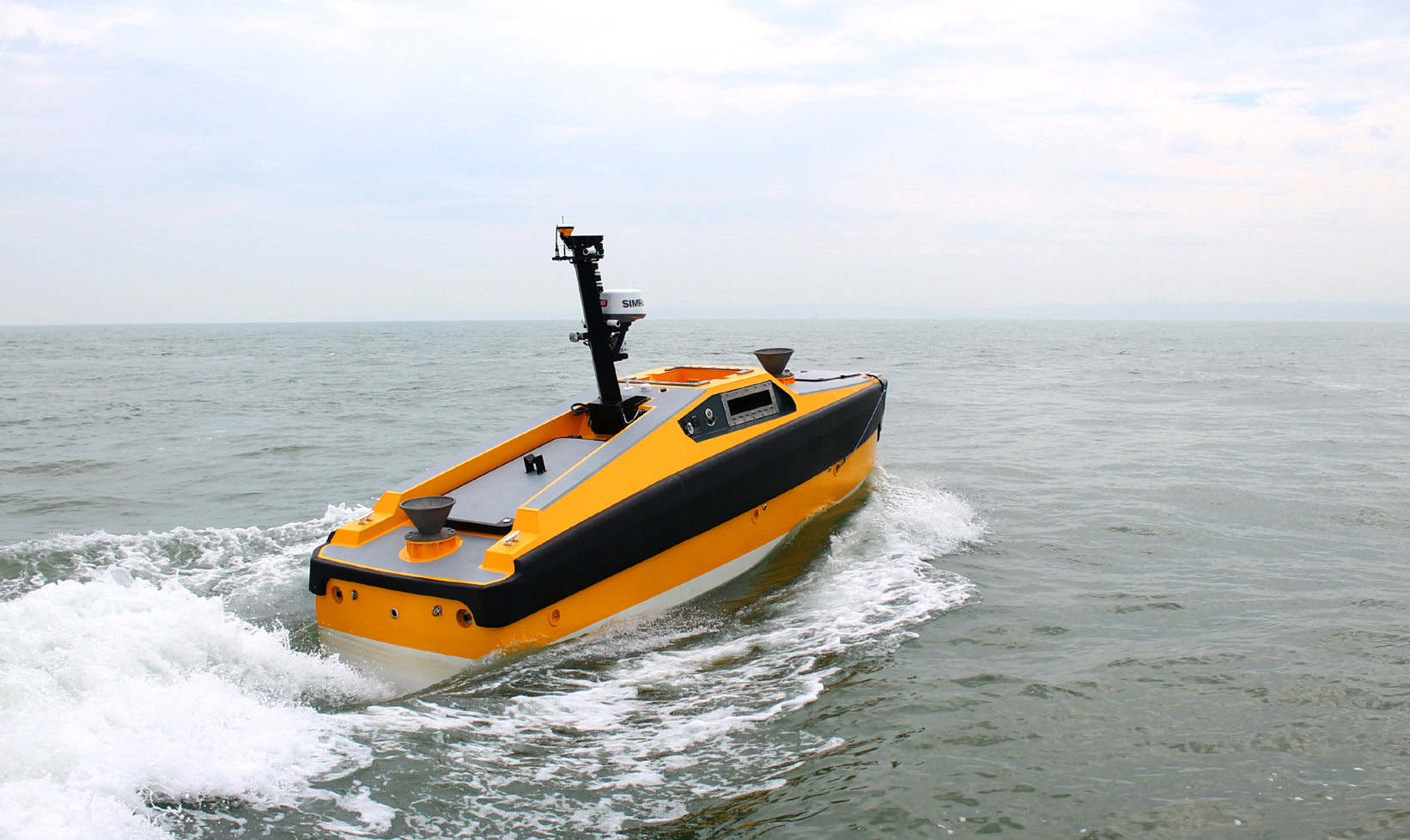
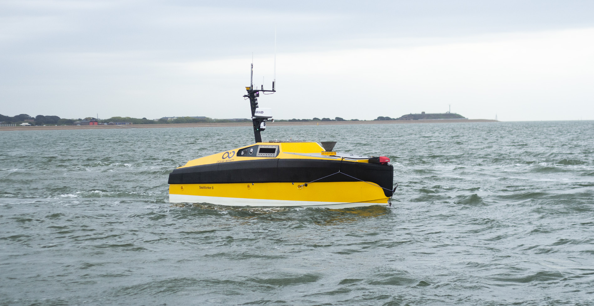
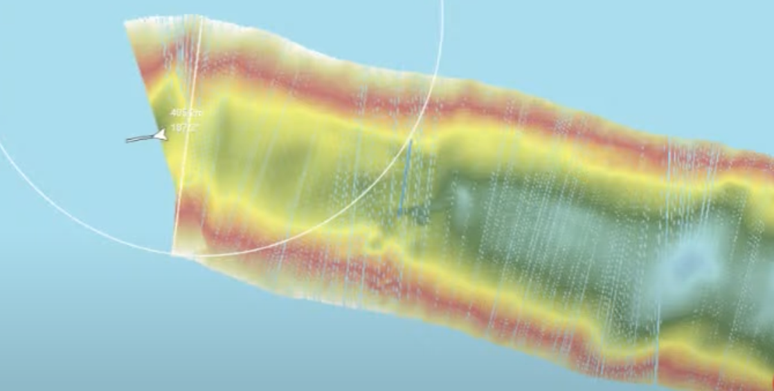
The search of the area in Western Lake Superior, adjacent to the Keweenaw Peninsula, will double as a technology demonstration and mapping opportunity to showcase the capabilities of the Automated Surface Vessel (ASV) and bathymetric surveys. As the Ocean Infinity’s Armada 8 (A8) cruises the mission area, mapping will be conducted via Norbit ultra-high-resolution 3D bathymetric sonar system. The addition of the Norbit technology will allow for the intake and display of real-time high-definition bathymetric images.
Daily Mission Updates
Monday, September 9, 2024
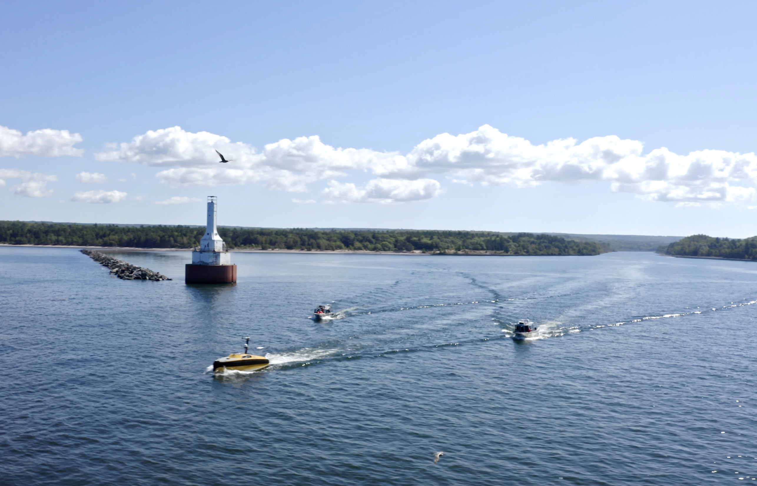
The mission to locate the missing NCAR plane commenced today with an initial transit to the survey area, located roughly 78 miles offshore and 10 miles west of Keweenaw Peninsula. The search is being conducted using advanced autonomous technology, including Michigan Technological University’s (MTU) Armada 8 Autonomous Surface Vehicle (ASV), provided by Ocean Infinity. The ASV is performing parallel line surveys alongside the crewed vessel, RV Soliton.
The team onboard, led by research engineer Travis White from MTU, includes experts monitoring real-time data from multi-beam sonar technology, which is being used to map the lakebed in high resolution. The depth ranges from 50 meters to 100+ meters, where they hope to identify debris that could belong to the missing plane.
Day one’s efforts focused on reaching the primary search site, with the team gathering valuable sonar data during the transit. The lakebed mapping not only contributes to the mission but also supports the larger Lakebed 2030 initiative, which aims to map the entirety of the Great Lakes. The search will continue with a focus on identifying any potential wreckage on the relatively smooth lakebed, which should help highlight any anomalies that could be remnants of the aircraft. The team is set for long days of data collection, with plans to return to shore each night.
-Summary by John Schmidt, Program Manager – GSGP
Tuesday, September 10, 2024
On Day 2 of the search for the missing NCAR plane in Lake Superior, the team continued their extensive survey operations. The RV Soliton, equipped with a multibeam echosounder, and the ASV worked in tandem to continue mapping the 21-square-mile area of Lake Superior west of Houghton. The ASV faced some technical challenges due to water ingress but was back in operation by mid-morning, collecting live data on the lake bed.
The crew is focusing on identifying reflective targets that might indicate aircraft debris. Meanwhile, Wayne Lusardi’s (Marine Archaeologist – Michigan DNR) vessel, equipped with a remotely operated vehicle (ROV) and side-scan sonar, is investigating promising targets flagged by the survey data. The team also encountered interesting geological features but has yet to definitively identify any wreckage, though they identified several potential targets that could yield results.
The day included a demonstration of real-time data analysis and coordination among the various teams, underscoring the complexity and thoroughness of the search effort.
-Summary by John Schmidt, Program Manager – GSGP
Wednesday, September 11, 2024
On Day 3 of the search, the crew experienced their roughest day on Lake Superior due to a significant swell. Despite this, both the RV Soliton and the Autonomous Surface Vehicle (ASV) continued their survey operations, running parallel lines in a lawnmower pattern to systematically map the lakebed. The ASV, positioned about a mile and a half north of the Solon, was praised by the team for its precision in following survey lines, which is a critical factor in obtaining accurate data and difficult for human operators to achieve. The crew also discussed the technical aspects of the survey, including the importance of sound velocity profiles for accurate sonar data collection.
The team is focusing on an area identified by the state’s maritime archaeologist, who used historical data and debris drift calculations to define the search zone. The survey operations involve overlapping swathes of the lakebed to ensure comprehensive coverage. Excitingly, the team has already identified several potential targets on the lakebed, including what might be a shipwreck. These findings will guide future reconnaissance efforts and involve the deployment of an underwater vehicle for closer inspection.
-Summary by John Schmidt, Program Manager – GSGP
Thursday, September 12, 2024
On the fourth day of the mission, the team continued the search for the NCAR plane. The MTU team, supported by the Smart Ships Coalition and industry partners, has now successfully surveyed over 100% of the planned area and has extended their search beyond the original survey zone. This extra effort is aimed at maximizing the chances of finding any remaining wreckage.
Three vessels were active today. The primary vessel, the uncrewed Armada 8, conducted autonomous data collection, while the RV Soliton and a third vessel supported with additional multi-beam echosounder surveys and target investigations using AUVs and ROVs. Despite technical difficulties during live feeds, the teams remained in high spirits, working under calm weather conditions. While no definitive aircraft wreckage has been identified, the extra data collected could hold crucial clues as the mission progresses.
The day concluded with the launch of an AUV to investigate potential targets, marking another step forward in the ongoing search efforts. The team is optimistic, continuing to leverage advanced sonar and imaging technologies to uncover evidence of the long-lost plane.
-Summary by John Schmidt, Program Manager – GSGP
Friday, September 13, 2024
On the final day of the search mission, the team successfully completed their survey and returned to the Great Lakes Research Center (GLRC) at Michigan Technological University. During a live stream update at the GLRC, the team shared impressive mapping results from the 21-square-mile search area. Using two multibeam sonar systems—one from Norbit and another from Kongsberg—they captured high-resolution data showing a comprehensive map, including bedform geology and glacial features.
Preliminary sonar data identified a number of targets, including one object with a form factor that could suggest a vessel or large debris. Many smaller scattered sites were also marked. While initial data analysis has begun, the team will need a few weeks of post-processing to definitively identify potential wreckage. Several promising targets will require further exploration using an underwater ASV.
The team will present their preliminary results and insights at the upcoming Lakebed 2030 conference in Traverse City, Michigan, where Ocean Infinity will also showcase their vessel. Overall, the mission was a success, marking the first time such high-quality mapping with an ASV has been conducted in the Great Lakes region.
A special thanks goes to the Smart Ships Coalition’s partners and sponsors: the Great Lakes St. Lawrence Governors & Premiers, Michigan Technological University, Norbit, Ocean Infinity, Kongsberg, QPS, the Great Lakes Shipwreck Museum, the National Museum of the Great Lakes, Michigan Economic Development Corporation, Michigan Office of Environment, Great Lakes and Energy, Interlake Maritime Services, and the Great Lakes Observing System. The team is eager to continue processing the data and ground-truthing these potential sites.
-Summary by John Schmidt, Program Manager – GSGP
Mission Support & Sponsors
