The Straits of Mackinac are a particularly dynamic region and are a critical area for real-time observations. Lakes Huron and Michigan converge at the Straits, making it a major shipping passage, as well as a significant commercial and recreational route; being commonly used by ferries and recreational vessels. Additionally, it is an energy corridor, with the Enbridge Line 5 Oil Pipeline running across the bottom of the waterway, parallel to the ever-iconic Mackinac Bridge.

The observing assets that help inform the many users with real-time conditions include: two moored buoys and two high frequency radars.
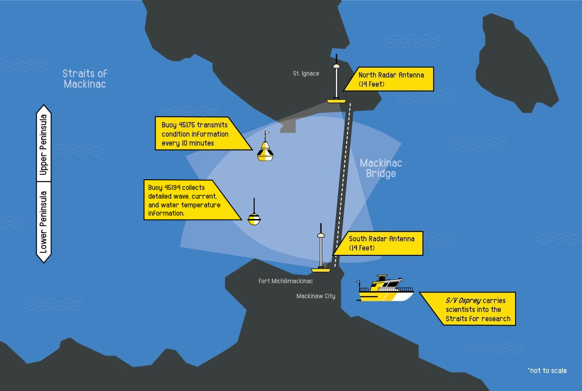
Buoys
Two real-time buoys are deployed seasonally in the Straits by Michigan Technological University’s Great Lakes Research Center. The McGulpin Point buoy is a designated wave buoy that measures a suite of wave parameters. Nearby, the Mackinac Straits West buoy measures meteorological and water current information, in addition to waves.
Take a look at the buoys on Seagull.

Being able to use remote sensing to measure real time water conditions and surface currents over roughly a 10 square mile area in the Straits of Mackinac is an important regional accomplishment. The narrow channel between Lakes Michigan and Huron sees strong oscillating currents in an area with pipelines underneath and heavy shipping traffic.
The first set of high-frequency radars (HFR) in the Great Lakes is located at the Straits, on either side of the passage. Also installed and operated by MTU GLRC, the system was supported with funding from GLOS and the Michigan Department of Environment, Great Lakes, and Energy (EGLE). The HFR’s electromagnetic pulses bounce off the waters of the Straits. producing a highly detailed surface current map every hour to support:
- Navigation and boater safety
- Search and rescue operations
- Spill response

The Pacific and Atlantic coastal communities heavily rely on HFR technology for oil spill tracking and US Coast Guard search and rescue efforts. Although the technology has not yet been as widely adopted in the Great Lakes, the HFR at the Straits is still an important tool. The U.S. Army Corps of Engineers has been surveying the area and recently completed an environmental impact statement for the Line 5 Tunnel project. Michigan EGLE is reviewing the project with a public notice period running through August 29, 2025. In a worst case scenario, the HF Radar can help forecast the flow of hazardous materials in the Straits.
The Straits of Mackinac are beautiful and critical. This area represents many things to many people, but most easily seen is the connection it represents: of Lakes Huron and Michigan, of the Upper and Lower Peninsulas of Michigan, and of people and the water. Remote observing assets at this crucial juncture ensure informed enjoyment of the area and the Great Lakes as a whole.
Find HFR data through MTU (live data back online August 5, 2025).